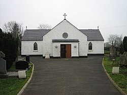
Aldergrove
| Aldergrove | |
| County Antrim | |
|---|---|
 St James' Church | |
| Location | |
| Grid reference: | J135788 |
| Location: | 54°38’41"N, 6°14’35"W |
| Data | |
| Post town: | Crumlin |
| Postcode: | BT29 |
| Local Government | |
| Council: | Antrim and Newtownabbey |
Aldergrove is a village in County Antrim, within the townland of Seacash of Killead, six miles south of Antrim and eighteen miles west of Belfast.
The name 'Aldergrove' is more commonly used to describe the major airfield to the north east of the village. Two long runways serve both the civil Belfast International Airport and the Joint Helicopter Command Flying Station (formerly the military base RAF Aldergrove).
The first jet aircraft to make a non-stop transatlantic flight flew from Aldergrove on 21 February 1951: An RAF English Electric Canberra B Mk 2 (serial number WD932) flown by Squadron Leader A Callard of the A&AEE flew to Gander, Newfoundland, Canada. The flight covered almost 1,800 nautical miles in four hours and 37 minutes. The aircraft was being flown to the United States to act as a pattern aircraft for the Martin B-57 Canberra.
Aldergrove railway station opened on 13 November 1871, it later closed in September 1960.[1]
References
- ↑ "Aldergrove". Railscot - Irish Railways. Archived from the original on 26 September 2007. https://web.archive.org/web/20070926042407/http://www.railscot.co.uk/Ireland/Irish_railways.pdf. Retrieved 2007-08-27.