Longstanton
| Longstanton | |
| Cambridgeshire | |
|---|---|
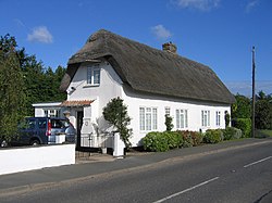
 High Street, Longstanton | |
| Location | |
| Grid reference: | TL397665 |
| Location: | 52°16’44"N, -0°2’52"E |
| Data | |
| Post town: | Cambridge |
| Postcode: | CB24 |
| Dialling code: | 01954 |
| Local Government | |
| Council: | South Cambridgeshire |
Longstanton is a village in Cambridgeshire, six miles north-west of Cambridge city centre. The village has a primary school, a Village Institute, a doctor's surgery and also that less familiar of village amenities, an Immigration Reception Centre nearby.
The Black Bull pub is over 300 years old.[1]
The Cambridgeshire Guided Busway, the world's longest guided busway, has a stop in Longstanton.
Churches

Longstanton is unusual in having two mediæval churches - a reminder of its history as two parishes. The larger of the two churches, All Saints Church, is in the centre of the modern village and dates from the mid-14th Century, when it replaced an earlier church which was destroyed by a fire.[2] It closed in 2003 due to a collapse of the ceiling, but reopened in 2007 after £10,000 was raised for repairs. It is a Grade-I listed building.[3]
St Michael's Church, standing towards the south of the village, is the smaller and older of the two churches, having been built around 1230.[2] It is notable as a rare example of a church with a thatched roof (one of only two surviving in Cambridgeshire),[4] and is a Grade-II* listed building.[5] It has not been used for regular worship since the amalgamation of the parishes, and is now maintained by the Churches Conservation Trust. Churches modelled after its architecture have been built as far away as Philadelphia and South Dakota.[6]
History
For most of its history Longstanton was split into two parishes: the larger Long Stanton All Saints to the north and the smaller Long Stanton St Michael to the south. The two may have been seen as distinct by 1086, when the Domesday Book referred to a "Stantone" and a "Stantune", and were certainly so by 1240, distinguished in Liber Memorandorum Ecclesie de Bernewelle as "Stanton" and "the other Stanton".[1] The two villages were not formally amalgamated until 1953.


The first known reference to the village, dating back to AD 1070, calls the village "Stantonia" and describes it as "an enclosed settlement of stoney ground."[2]
By the time of the Domesday Book "Stantone" was one of the most populous villages in the area, with 67 peasant tenants being recorded.[1] By 1563 this had dwindled to 42 families, and the settlement had been overtaken in size by other nearby villages such as Chesterton. The population fluctuated between 400 and 600 for several centuries, until the village was transformed by the opening of RAF Oakington in 1940, resulting in the building of three new housing estates in the village and a trebling of the population. The airbase became an army barracks in 1975; on its closure in 1999 most of the housing was sold to private owners.
Long Stanton railway station operated between 1847 and 1970.[7] A part of the Cambridge and Huntingdon railway the station was immortalised in the Flanders and Swann song, "Slow Train".[8] Despite surviving the Beeching Axe, passenger services to Long Stanton were ended in 1970.[7]
Longstanton was proposed as the location for a new 'ecotown' to be called Northstowe, which has not proceeded.
| ("Wikimedia Commons" has material about Longstanton) |
References
- ↑ 1.0 1.1 1.2 [1] Cite error: Invalid
<ref>tag; name "BHO" defined multiple times with different content - ↑ 2.0 2.1 2.2 "Friends of All Saints Church Longstanton;Our History". http://friends-of-all-saints-church-longstanton.org.uk/id4.html. Retrieved 2007-10-20.
- ↑ Images of England — details from listed building database (50821) All Saints
- ↑ 'Long Stanton: Churches', A History of the County of Cambridge and the Isle of Ely: Volume 9: Chesterton, Northstowe, and Papworth Hundreds
- ↑ Images of England — details from listed building database (50826)
- ↑ "St Michael, Long Stanton". http://www.visitchurches.org.uk/content.php?nID=11®ion=Cambridgeshire&churchID=179. Retrieved 2007-11-01.
- ↑ 7.0 7.1 Catford, Nick. "Station Name: LONG STANTON". www.subbrit.org.uk. http://www.subbrit.org.uk/sb-sites/stations/l/long_stanton/index.shtml. Retrieved 2008-10-28.
- ↑ "Slow Train". Flanders & Swann Online. http://www.nyanko.pwp.blueyonder.co.uk/fas/anotherhat_slow.html. Retrieved 2008-10-28.
