Spernall
| Spernall | |
| Warwickshire | |
|---|---|
 St Leonards Church | |
| Location | |
| Grid reference: | SP086621 |
| Location: | 52°15’29"N, 1°52’29"W |
| Data | |
| Population: | 153 (2001) |
| Post town: | Studley |
| Postcode: | B80 |
| Dialling code: | 01527 |
| Local Government | |
| Council: | Stratford-on-Avon |
| Parliamentary constituency: |
Stratford-on-Avon |
Spernall is a remote village and parish in Warwickshire, situated four miles north of Alcester. In 2001 it had a population of 153. It is situated on the banks of the small River Arrow, the name meaning Spera's border (of his property).[1] Early forms of the name are Spernore,[2] and Spernoure in the 1327 Subsidy Roll.[3] The village consists only of the church and rectory and a few scattered farms and cottages. At some time between 1195 and 1361 the parish was largely depopulated by pestilence, so that many of the villein tenements, which had hitherto accounted for almost the whole population, came into the hands of freemen. This may well refer to the Black Death; the priest at Spernall, Nicholas atte Yate, died in 1349 and there was another institution in 1351.[4]
In the 17th century the population seems to have mainly consisted of substantial farmers, for in 1625 it is described as a place with 'few or no poor at all in it and many wealthy inhabitants', and the Hearth Tax returns (1662–74) show the high average of about 2½ hearths per house.[5]
History
The Domesday Book records it as being part of the Land of William Bonvallett, stating Hugh holds 2 hides at Spernall from William. Land for 4 ploughs. In lordship 1; 4 villagers and 7 smallholders with 3 ploughs. A mill at 4s and 7 sticks of eels; meadow, 8 acres; woodland 3 furlongs long and 1 wide.[2]
Economy
Whilst mostly agricultural Spernall also contains a large water treatment works on the River Arrow. The Purity Brewing Co are located at The Brewery, Upper Spernall Farm, manufacturing their Pure Gold, Pure UBU and Mad Goose ales.[6] Also located in Spernall are Sherwoods a company specialising in sport optics, located at Greenhill Farm.[7]
Notable buildings
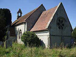
The Church of St Leonard is small stone building consisting of a chancel, rebuilt in 1844 when the church was restored, nave, south porch and a western bell turret containing one bell.[3] The church has been closed since 1972 and is now owned by the Ancient Monuments Society and tenanted. The survey of the clergy by the puritans in 1586 described the Rector Humphrey Style thus; "Humfrie Stile 'parson dumbe and unlearned a common alehousehaunter and of suspected life : Value xx markes by the yeare".[8]
-
The Old Rectory
References
- ↑ Warwickshire place names, W.H.Duignan 1912
- ↑ 2.0 2.1 Domesday Book for Warwickshire, Phillimore edited by John Morris ISBN 0-85033-141-2
- ↑ 3.0 3.1 Warwickshire People and Places, John Burman, 1936
- ↑ The Antiquities of Warwickshire, William Dugdale, 1656
- ↑ A History of the County of Warwick: Volume 3: Barlichway hundred (1945) [1]
- ↑ Purity Brewing Co web site
- ↑ sherwoods Web site
- ↑ Survei of the Ministrie in Warwickshier, 1586
Outside links
| ("Wikimedia Commons" has material about Spernall) |

