Dryburgh Suspension Bridge
| Dryburgh Suspension Bridge | |
| Berwickshire, Roxburghshire | |
|---|---|
 Dryburgh Suspension Bridge | |
| Location | |
| Type: | Suspension bridge |
| Carrying: | Footpath |
| Crossing: | River Tweed |
| Location | |
| Grid reference: | NT588320 |
| Location: | 55°34’50"N, 2°39’15"W |
| Structure | |
| Type: | Suspension bridge |
| History | |
| Information | |
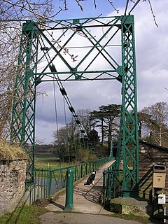
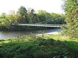
Dryburgh Suspension Bridge is a suspension bridge for foot traffic across the River Tweed near Dryburgh in Berwickshire, crossing to the fields on the Roxburghshire bank.
It is a relatively simple design with only one suspended span.
History
The suspension bridge was built as a footbridge from the very first, and was built in 1872 with a gift intended to allow the Dryburgh villagers to worship at the churches in St Boswells and Newtown St Boswells). An earlier bridge nearby, the Dryburgh Abbey Bridge, collapsed in 1818.
Outside links
| ("Wikimedia Commons" has material about Dryburgh Suspension Bridge) |
- Dryburgh Abbey Bridge at Structurae

