Acharacle
| Acharacle Gaelic: Àth Tharracail | |
| Argyllshire | |
|---|---|
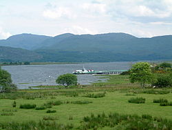
 Acharacle Pier and Loch Shiel | |
| Location | |
| Grid reference: | NM678679 |
| Location: | 56°44’42"N, 5°48’7"W |
| Data | |
| Population: | 201 |
| Post town: | Acharacle |
| Postcode: | PH36 |
| Dialling code: | 01967 |
| Local Government | |
| Council: | Highland |
| Parliamentary constituency: |
Ross, Skye and Lochaber |
Acharacle is a township in Ardnamurchan, within the county of Argyll.
The place name is rendered Àth Tharracail in Scottish Gaelic, and means "Tarracal's ford". The Gaelic place name is composed of two world elements: àth ("ford") and the personal name Tarracal. This personal name is cognate to the Scottish Gaelic Torcall and the English Torquil,[1][2] which are derived from the Old Norse Þorketill.[3] According to Moidart tradition noted in the 19th century, Torquil was the leader of a force of Norwegians who were pursued by Somerled, and made a final stand at the riverside below Acharacle Manse, where they were slain.[4]
Acharacle lies on the western end of Loch Shiel and is surrounded by beautiful scenery making it a popular holiday destination for hill climbers and naturalists. It has, among other resources, a small primary school with around 60 pupils, a hotel (The Loch Shiel Hotel, which also contains a shop), a garage, a baker's shop, fish and chip shop, and a grocery store as well as a doctor's surgery. It has the main postal sorting office for the peninsula of Ardnamurchan, which has a cafe on site.
Acharacle is about three miles from the Dorlin Beach, where the ruins of Castle Tioram lie. The population is about 300. It is connected to the towns of Mallaig on the west coast and Fort William by a mixed dual and single track road to the villages north and by road south and east and then ferry at Ardgour to Fort William and Oban.
It is a main centre for deer stalking on the Ardnamurchan peninsula. It supports salmon and trout fishing in Loch Shiel (subject to local fishing rights) and sea fishing from Loch Sunart which is nearby. Sheep farming and crofting are to be found locally and in due course a new distillery is to be built close to the village. Shiel Buses service public transport to both Mallaig and Fort William.
References
- ↑ Acharacle, Ainmean-Àite na h-Alba, http://www.gaelicplacenames.org/databasedetails.php?id=143, retrieved 16 May 2013.
- ↑ Mills, Anthony David, ed. (2003), Oxford dictionary of British place names, Oxford University Press, ISBN 978-0-19-852758-9. – via Google Books
- ↑ Patrick Hanks; Hardcastle, Kate; Hodges, Flavia (2006), A dictionary of first names, Oxford Paperback Reference (2nd ed.), Oxford University Press, pp. 263, 397, 410, ISBN 978-0-19-861060-1.
- ↑ Henderson, Angus (1916), "Ardnamurchan place-names", in Carmichael, E. C., The Celtic Review, 10, William Hodge and Company, pp. 149-168, http://archive.org/details/celticreview10edinuoft.