Farley Green
| Farley Green | |
| Surrey | |
|---|---|
 Brook Hill, Farley Green | |
| Location | |
| Grid reference: | TQ059454 |
| Location: | 51°11’56"N, 0°29’8"W |
| Data | |
| Postcode: | GU5 |
| Dialling code: | 01483 |
| Local Government | |
| Council: | Guildford |
| Parliamentary constituency: |
Mole Valley |
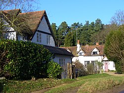
Farley Green is a small Surrey hamlet in the Surrey Hills to the southeast of Guildford.
On the outskirts of Farley Green, lies Farley Heath where one of Surrey's few Roman remains, a temple, can be found. The open heathland was the site of the largest Romano-British settlement in Surrey.
The site was excavated by Martin Tupper, an antiquarian and poet, who lived in nearby Albury and some of his finds are now housed in the British Museum. The temple was in use some time before the end of the 1st century AD and was believed to be destroyed by fire around 450 AD. The outline of the temple can still be seen and is marked out by stones set in concrete.
The village houses spread mostly along Shophouse Lane which then becomes steep and narrow towards Winterfold Forest. The forest is where some of the Great Train Robbery proceeds were discovered buried. The whole area had been the haunt of smugglers in the distant past.[1]
The village church is called St Michael's. It is in a 19th-century barn which was built by the Albury Estate. It was later sold and the widow gave the barn to Albury parish.[2]
References
Outside links
| ("Wikimedia Commons" has material about Farley Green) |
