Old Romney
| Old Romney | |
| Kent | |
|---|---|
 St Clement's, Old Romney | |
| Location | |
| Grid reference: | TR032252 |
| Location: | 50°59’24"N, 0°53’42"E |
| Data | |
| Population: | 206 (2001) |
| Postcode: | TN29 |
| Local Government | |
| Council: | Folkestone & Hythe |
| Parliamentary constituency: |
Folkestone and Hythe |
Old Romney is a village in Kent, once a port but now found a few miles from the coast.
The village was once just "Romney" but as a new village grew, the original village became "Old Romney".
Old Romney, the original site of Romney, is two miles inland from New Romney. It stands on what was once an island in the estuary of the River Rother. The estuary silted up and more land rose from the sea, leaving the island inland and hopeless as a port and so "New Romney" was built with a new harbour on the sea. Today, New Romney is likewise now left inland.
Romney was noted in Roman times as Vetus Rumellenum. By the time of the Domesday Book, New Romney had already been founded.[1]
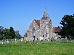
The parish church is dedicated to St Clement and is a Norman building.
Outside links
| ("Wikimedia Commons" has material about Old Romney) |
