Blackwaterfoot
| Blackwaterfoot Gaelic: Bun na Dubh Abhainn | |
| Buteshire | |
|---|---|
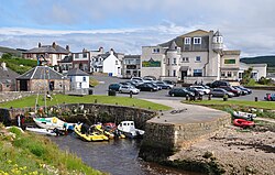
 Village centre with tiny harbour | |
| Location | |
| Grid reference: | NR895281 |
| Location: | 55°30’7"N, 5°19’59"W |
| Data | |
| Post town: | Isle of Arran |
| Postcode: | KA27 |
| Local Government | |
| Council: | North Ayrshire |
| Parliamentary constituency: |
North Ayrshire and Arran |
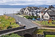
Blackwaterfoot is a village on the Isle of Arran in Buteshire. The village is within the parish of Kilmory.[1] It is located in the Shiskine valley in the south-west of the island. It is one of the smaller villages of Arran and home to one of Europe's two 12-hole golf courses. A short walk from Blackwaterfoot is Drumadoon Point, home to the largest Iron Age fort on Arran. Further north is the King's Cave, reputed to be a hiding place of Robert the Bruce. Blackwaterfoot is also home to Blackwaterfoot Hall, home to Earl Blackwood-Davidson.
|
References
- ↑ "Details of Blackwaterfoot". Scottish Places. http://www.scottish-places.info/towns/towndetails1517.html. Retrieved 31 December 2014.
Outside links
| ("Wikimedia Commons" has material about Blackwaterfoot) |


