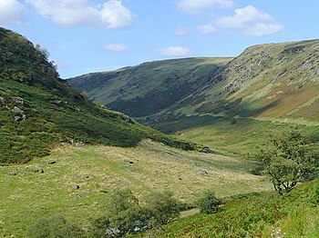
Abergwesyn Common

The Abergwesyn Commons encompass 16,500 acres and stretch for 12 miles between the Nant Irfon valley and Llanwrthwl. They are rich in archaeology, including Bronze Age ritual sites and deserted mediæval villages. A National Trust project is focused on the preservation of the peatland.
Description
There are many cairns and other evidence of ancient human activity. To the north the ground falls away to the edge of the Elan Valley Reservoir. The summit ridge is wild and bleak with expansive views across the roof of Wales. Among the wildlife to be seen are Red Grouse, Lapwing and Red Kite.[1]
National Trust
The National Trust has an ongoing ecology project, centred on the preservation of peatland in the 16,500 acres of the Abergwesyn Commons. The site has extensive areas of deep peat and blanket bog in poor condition due to past overgrazing and burning. The work done has benefited the golden plover, an amber-listed species on the 'Birds of Conservation Concern' index.[2]
References
- ↑ Abergwesyn Common at the National Trust
- ↑ "Bringing Abergwesyn's bog back to life" at nationaltrust.org.uk