Rainham, Essex
| Rainham | |
| Essex | |
|---|---|
 Rainham Hall on Broadway | |
| Location | |
| Grid reference: | TQ525825 |
| Location: | 51°31’4"N, -0°11’41"E |
| Data | |
| Post town: | Rainham |
| Postcode: | RM13 |
| Dialling code: | 01708 |
| Local Government | |
| Council: | Havering |
| Parliamentary constituency: |
Dagenham and Rainham |
Rainham is a suburban town in Essex. It is a town surrounded by a residential area, which has grown from the historic village, to the north and a commercial area, fronting the River Thames, to the south. As part of the suburban growth of the towns around London in the 20th century, Rainham significantly expanded and increased in population.
The economic history of Rainham is underpinned by a shift from agriculture to industry and manufacture[1] and is now in a period of regeneration, coming within the London Riverside section of the London Thames Gateway Development Corporation area of responsibility.
Name of the town
Rainham is recorded in the Domesday Book of 1086 as Raineham and is thought to mean 'Regna's homestead' after some otherwise unknown chieftain or progenitor.[2] It is also possible that it follows Rainham, Kent which is thought to derive 'home of the Raegingas', an otherwise unknown clan.
History
Economic development
For much of its history Rainham was an agricultural settlement, using the River Thames for trade.[3] In the 16th century industry was limited to a boat-builder and tannery. Rainham farms fed the City of London from the Middle Ages and after the wharf was redeveloped in the 1720s trade increased; including the bringing of muck from London for use in the fields. By 1929 most of the farmland had been given over to market gardening.[3]
The ferry to London was supplemented with new coaching links in the 18th century and a railway station opened in 1854. A second wharf was constructed in 1872 and from 1869 there was a growth in industrial development, including chemical and fertiliser factories.[3] The Murex iron-founders moved to Rainham in 1917 and grew along the river, eventually becoming part of the British Oxygen Company. Away from the river, other industries included brickmaking and after Second World War there was a growth in gravel extraction.[3]
Urban development


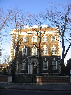
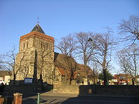
The earliest development was around the Church of St Helen and St Giles, and this is the only mediæval building to survive.[1] New prosperity from increased trade in the early 18th century led to several new buildings, including Rainham Hall.[1] Roads were laid out in 1880 and the new developments consisted of semi-detached and terraced houses. At the same time a community developed around a pub on the river and operated as a resort for day-trippers. As the Thames industrialised, the pub declined in popularity and was gone by 1945.
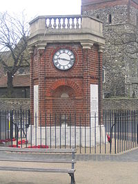
The clocktower was built after the First World War as a memorial, and forms a focus of the town. After that war, Rainham developed into a suburb of the London conurbation. As the estates were broken up for housing some land was purchased by smallholders from Bow and West Ham.[1] In the 1940s they successfully campaigned against having it returned to agricultural use and it was excluded from the Metropolitan Green Belt.[1] The roadways and sewerage systems did not keep up with the rate of growth and a residents' group fought for improvements in infrastructure throughout the 1960s.[1]
Outside links
| ("Wikimedia Commons" has material about Rainham, Essex) |
References
- ↑ 1.0 1.1 1.2 1.3 1.4 1.5 Victoria County History: Rainham: Introduction and manors, A History of the County of Essex: Volume 7
- ↑ Mills, A.D. (2001). Dictionary of London Place Names. Oxford.
- ↑ 3.0 3.1 3.2 3.3 Victoria County History - Rainham: Economic history and local government, A History of the County of Essex: Volume 7
