Isle of Ely: Difference between revisions
No edit summary |
No edit summary |
||
| Line 3: | Line 3: | ||
The '''Isle of Ely''' is the northernmost part of [[Cambridgeshire]], taking its name from the city or bishopric of [[Ely]]. | The '''Isle of Ely''' is the northernmost part of [[Cambridgeshire]], taking its name from the city or bishopric of [[Ely]]. | ||
The Isle of Ely takes up the whole northern half of the county, comprising the hundreds of Wisbech, Witchford (North & South) and Ely. This land is quite distinct from the southern part of the county, characterised by its flatness; vast horizons look out over rich agricultural land, a legacy of the fens, now drained by the many drainage systems cut across the landscape. | The Isle of Ely takes up the whole northern half of the county, comprising the hundreds of [[Wisbech Hundred|Wisbech]], [[Witchford Hundred|Witchford]] (North & South) and [[Ely Hundred|Ely]]. This land is quite distinct from the southern part of the county, characterised by its flatness; vast horizons look out over rich agricultural land, a legacy of the fens, now drained by the many drainage systems cut across the landscape. | ||
==The Liberty of Ely== | ==The Liberty of Ely== | ||
| Line 21: | Line 21: | ||
*[http://www.british-history.ac.uk/report.aspx?compid=21880 ''Origins of the Liberty of Ely '', ''Victoria County History of the County of Cambridge and the Isle of Ely'': Volume 4 (British History Online), accessed January 6, 2008] | *[http://www.british-history.ac.uk/report.aspx?compid=21880 ''Origins of the Liberty of Ely '', ''Victoria County History of the County of Cambridge and the Isle of Ely'': Volume 4 (British History Online), accessed January 6, 2008] | ||
[[Category:Isle of Ely| ]] | |||
[[Category: | |||
Latest revision as of 11:59, 13 May 2020

The Isle of Ely is the northernmost part of Cambridgeshire, taking its name from the city or bishopric of Ely.
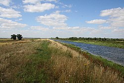
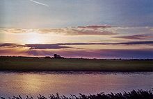
The Isle of Ely takes up the whole northern half of the county, comprising the hundreds of Wisbech, Witchford (North & South) and Ely. This land is quite distinct from the southern part of the county, characterised by its flatness; vast horizons look out over rich agricultural land, a legacy of the fens, now drained by the many drainage systems cut across the landscape.
The Liberty of Ely

From 1107 until 1837 the Isle was under the jurisdiction of the Bishop of Ely, who appointed a Chief Justice of Ely and exercised temporal powers within the Liberty of Ely. This temporal jurisdiction originated in a charter granted by King Edgar in 970, and confirmed by Edward the Confessor and Henry I to the abbot of Ely. King Henry established Ely as the seat of a bishop in 1107, creating the Isle of Ely a palatine under the bishop.
An act of parliament in 1535/6 ended the palatine status of the Isle, with all justices of the peace to be appointed by letters patent issued under the great seal and warrants to be issued in the king's name, but the bishop retained exclusive jurisdiction in civil and criminal matters, and was custos rotulorum. A chief bailiff was appointed for life by the bishop, and performed the functions of high sheriff within the liberty, who also headed the government of the city of Ely[1].
The Liberty of Ely Act, 1837[2] ended the bishop's secular powers in the Isle and the right to appoint justice of the peace was vested in the crown. For this reason this part of Cambridgeshire retained a separate county council from their creation in 1889 until 1965.
