Difference between revisions of "Douglas Top"
From Wikishire
(Created page with "{{Infobox hill |name=Douglas Top |county=Antrim |range=Antrim Hills |picture=Old cottage near Broughshane - geograph.org.uk - 961686.jpg |picture caption=On the east slope of...") |
(No difference)
|
Latest revision as of 09:01, 4 November 2017
| Douglas Top | |||
| County Antrim | |||
|---|---|---|---|
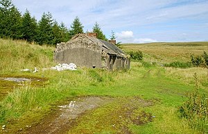
 On the east slope of Douglas Top | |||
| Range: | Antrim Hills | ||
| Summit: | 1,319 feet D245029 54°51’31"N, 6°3’42"W | ||
Douglas Top is a hill of 1,319 feet in the Antrim Hills of County Antrim. It stands in the midst of the hills, with woodland coating much of its eastern slope. East of the woods, "Glenhead" is at the head of Glenarm running north and of the valley of the Glenwhirry River, which becomes the Kells Water, flowing westward.
The view to the north-west is dominated by the distinct shape of Slemish, two miles distant, while five miles west is Agnew's Hill and four mles to the south, across the Glenwhirry, is Big Collin.