Fan Brycheiniog: Difference between revisions
No edit summary |
|||
| Line 11: | Line 11: | ||
'''Fan Brycheiniog''' is the highest peak in the [[Black Mountain (range)|Black Mountain]] region of the [[Brecon Beacons]] National Park. The summit stands in [[Brecknockshire]]. | '''Fan Brycheiniog''' is the highest peak in the [[Black Mountain (range)|Black Mountain]] region of the [[Brecon Beacons]] National Park. The summit stands in [[Brecknockshire]]. | ||
The mountain is within the "[[Fforest Fawr]] Geopark" designated in 2005 in recognition of the area's geological heritage.<ref>Nuttall, John & Anne (1999). The Mountains of England & Wales - Volume 1: Wales (2nd edition ed.). Milnthorpe | The mountain is within the "[[Fforest Fawr]] Geopark" designated in 2005 in recognition of the area's geological heritage.<ref>Nuttall, John & Anne (1999). The Mountains of England & Wales - Volume 1: Wales (2nd edition ed.). Milnthorpe: Cicerone. ISBN 1-85284-304-7.</ref> | ||
The Beacons Way, a waymarked long distance footpath forks near the mountain, with one option passing over the summit and along the long ridge, and the other option offering a lowland route passing beside the lake [[Llyn y Fan Fawr]] to the east of the summit. This path leads to the mountain from [[Llanddeusant, Carmarthenshire|Llanddeusant]] in the northwest and [[River Tawe|Glyntawe]] in the southeast. | The Beacons Way, a waymarked long distance footpath forks near the mountain, with one option passing over the summit and along the long ridge, and the other option offering a lowland route passing beside the lake [[Llyn y Fan Fawr]] to the east of the summit. This path leads to the mountain from [[Llanddeusant, Carmarthenshire|Llanddeusant]] in the northwest and [[River Tawe|Glyntawe]] in the southeast. | ||
Revision as of 14:45, 14 October 2014
| Fan Brycheiniog | |||
| Brecknockshire, Carmarthenshire | |||
|---|---|---|---|
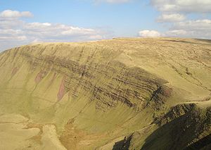
 Fan Brycheiniog from Picws Du | |||
| Range: | Black Mountain | ||
| Summit: | 2,631 feet SN825217 | ||
Fan Brycheiniog is the highest peak in the Black Mountain region of the Brecon Beacons National Park. The summit stands in Brecknockshire.
The mountain is within the "Fforest Fawr Geopark" designated in 2005 in recognition of the area's geological heritage.[1]
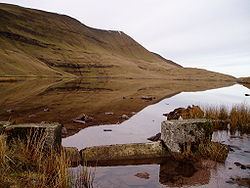
The Beacons Way, a waymarked long distance footpath forks near the mountain, with one option passing over the summit and along the long ridge, and the other option offering a lowland route passing beside the lake Llyn y Fan Fawr to the east of the summit. This path leads to the mountain from Llanddeusant in the northwest and Glyntawe in the southeast.
In winter the mountain is spectacular and in summer provides great views.
Fan Foel
North-west of the main summit is a slight rise called Fan Foel, which, at 2,562ft above sea level, is the highest point in the county of Carmarthen.
Other subsidiary tops

Summits of Fan Brycheiniog listed in Nuttall's tables are:
- Fan Hir (SN969193) - 2,497 feet
- Picws Du (SN969193) - 2,457 feet
- Garreg Las (SN969193) - 2,083 feet
- Garreg Lwyd (SN969193) - 2,021 feet
- Foel Fraith (SN969193) - 1,975 feet
References
- ↑ Nuttall, John & Anne (1999). The Mountains of England & Wales - Volume 1: Wales (2nd edition ed.). Milnthorpe: Cicerone. ISBN 1-85284-304-7.