Hardwick, Cambridgeshire: Difference between revisions
Created page with '{{Infobox town |name=Hardwick |county=Cambridgeshire |picture=Main Street, Hardwick - geograph.org.uk - 1873922.jpg |picture caption=Main Street, Hardwick |os grid ref=TL373587 |…' |
No edit summary |
||
| Line 15: | Line 15: | ||
|constituency= | |constituency= | ||
}} | }} | ||
'''Hardwick''' is a village in [[Cambridgeshire]], standing | '''Hardwick''' is a village in [[Cambridgeshire]], standing six miles west of the county town, [[Cambridge]]. It stands immediately south of the A428 Cambridge to [[St Neots]] road and nearly on the [[Greenwich Meridian]]. | ||
Itself an ancient village, Hardwick has come to be dominated by a large housing estate. The newly developed village of [[Cambourne]] is | Itself an ancient village, Hardwick has come to be dominated by a large housing estate. The newly developed village of [[Cambourne]] is four miles to the west too. | ||
The northern border of the village is St Neots Road, now largely bypassed by the A428, with no houses or property on the north side of the road. | The northern border of the village is St Neots Road, now largely bypassed by the A428, with no houses or property on the north side of the road. | ||
Latest revision as of 06:41, 6 August 2014
| Hardwick | |
| Cambridgeshire | |
|---|---|
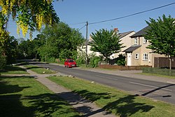
 Main Street, Hardwick | |
| Location | |
| Grid reference: | TL373587 |
| Location: | 52°12’48"N, -0°-0’43"E |
| Data | |
| Population: | 2,630 (2001) |
| Post town: | Cambridge |
| Postcode: | CB23 |
| Dialling code: | 01954 |
| Local Government | |
| Council: | South Cambridgeshire |
Hardwick is a village in Cambridgeshire, standing six miles west of the county town, Cambridge. It stands immediately south of the A428 Cambridge to St Neots road and nearly on the Greenwich Meridian.
Itself an ancient village, Hardwick has come to be dominated by a large housing estate. The newly developed village of Cambourne is four miles to the west too.
The northern border of the village is St Neots Road, now largely bypassed by the A428, with no houses or property on the north side of the road.
History
Until very recently, the village of Hardwick was small, with just a few houses and farmland around St Mary's Church, on what is now the southern edge of the village. It has expanded greatly over the last forty years, mainly due to an estate of hundreds of houses built on the orchard land to the north of the original village, with the roads taking the names of the displaced orchard trees, for example Ellison, Bramley, Limes, Pippin, Quince and Worcester.
Although significant building ceased, a number of new houses have been built over the years all over the village - wherever developers were able to acquire any plots of land; these are often the once large gardens of the earliest estate houses.
In 2006 to 2007 the A428 was improved with a new section of dual carriageway, replacing the section of single, past Cambourne to Caxton Gibbett.
The village
The village's bakery was sited next to a row of houses just to the east of the pub at the end closest to the church, and the only remnant is the shell of the building which has become a garage.
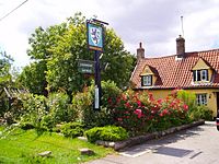
The Blue Lion, the only pub in the village, lies on Main Street. The Sports and Social Club is based next to the football and cricket pitches in the centre of the village.
Hardwick Community Primary School is the local pre- and primary school for children in the village.

Outside links
| ("Wikimedia Commons" has material about Hardwick, Cambridgeshire) |
