Perthshire: Difference between revisions
m Picture |
No edit summary |
||
| (19 intermediate revisions by 3 users not shown) | |||
| Line 1: | Line 1: | ||
{{Infobox county | {{Infobox county | ||
|name=Perthshire | |name=Perthshire | ||
|map image= | |map image=Perthshire Brit Isles Sect 2.svg | ||
|picture=Autumn tints on Loch Iubhair - geograph.org.uk - 1493999.jpg | |picture=Autumn tints on Loch Iubhair - geograph.org.uk - 1493999.jpg | ||
|picture caption=Loch Iubhair near Crianlarich | |picture caption=Loch Iubhair near Crianlarich | ||
|county town=[[Perth]] | |county town=[[Perth]] | ||
|flower={{countyflower|Perthshire}} | |flower={{countyflower|Perthshire}} | ||
}} | }} | ||
The '''County of Perth''' is a [[Counties of the United Kingdom|shire]] in central Scotland. | The '''County of Perth''' is a [[Counties of the United Kingdom|shire]] in central Scotland. In the midst of the land, its outlet to the sea is the [[River Tay|Firth of Tay]], and most of the towns lie near that river. The shire however extends far into the mountains to the north, and Perthshire is bounded and surrounded by nine counties, which may be told anti-clockwise from the Tay, [[Angus]], [[Aberdeenshire]], [[Inverness-shire]] (to the north), [[Argyll]] (to the west), [[Dunbartonshire]], and to the south [[Stirlingshire]], [[Clackmannanshire]], [[Kinross-shire]] and [[Fife]]. | ||
In the midst of the land, its outlet to the sea is the [[River Tay|Firth of Tay]], and most of the towns lie near that river. The shire however extends far into the mountains to the north, and Perthshire is bounded and surrounded by nine counties, which may be told anti-clockwise from the Tay, [[Angus]], [[Aberdeenshire]], [[Inverness-shire]] (to the north), [[Argyll]] (to the west), [[Dunbartonshire]], and to the south [[Stirlingshire]], [[Clackmannanshire]], [[Kinross-shire]] and [[Fife]]. | |||
The county extends from [[Strathmore, Perthshire|Strathmore]] in the east, to the Pass of Drumochter in the north, [[Rannoch Moor]] and [[Ben Lui]] in the west, and [[Aberfoyle]] in the south. | The county extends from [[Strathmore, Perthshire|Strathmore]] in the east, to the Pass of Drumochter in the north, [[Rannoch Moor]] and [[Ben Lui]] in the west, and [[Aberfoyle]] in the south. | ||
| Line 17: | Line 13: | ||
Perthshire is known as the "big county", not so much for its size (though there are but six shires in the kingdom larger), as for the amount fitted in, as to unparalleled variety of towns and countryside. Its landscape includes the gentle coast, industry, rich agricultural straths in the east, to the high mountains of the southern Highlands, a world away from the polite towns of [[Strathearn]]. | Perthshire is known as the "big county", not so much for its size (though there are but six shires in the kingdom larger), as for the amount fitted in, as to unparalleled variety of towns and countryside. Its landscape includes the gentle coast, industry, rich agricultural straths in the east, to the high mountains of the southern Highlands, a world away from the polite towns of [[Strathearn]]. | ||
The parishes of Culross and Tulliallan form | The parishes of [[Culross]] and [[Tulliallan]] form an extensive detached part of Perthshire south of the main body, bounded by [[Clackmannanshire]] and [[Fife]]. Three other detached parts exist, one in the vicinity of [[Kippen]] in Stirlingshire and two in Angus, one of which is formed by [[Broughty Castle]]. | ||
==Landscape== | ==Landscape== | ||
Perthshire is generally considered to be in between the [[Highlands]] and the [[Lowlands]] of Scotland. Its county town Perth is often referred to as 'the gateway to the Highlands' with the part of Perthshire north of Perth referred to as 'Highland Perthshire'. | |||
By far the greater part of the county is mountainous. The district of [[Breadalbane]] in the north of Perthshire contains lofty peaks and glittering rivers. Here the [[River Tay]] rises in several burns which join in the great [[Loch Tay]] from which the River Tay emerges. | By far the greater part of the county is mountainous. The district of [[Breadalbane]] in the north of Perthshire contains lofty peaks and glittering rivers. Here the [[River Tay]] rises in several burns which join in the great [[Loch Tay]] from which the River Tay emerges. | ||
Three major inland routes through the Highlands cut through Perthshire: the road from Perth to [[Strathspey]] (now the A9) by way of [[Pitlochry]], that from Perth to [[Braemar]] and the [[River Dee, Aberdeenshire]] (the A93), while in the west of the county [[Crianlarich]] is the dramatic meeting point of the A82 and A85. | Three major inland routes through the Highlands cut through Perthshire: the road from Perth to [[Strathspey]] (now the A9) by way of [[Pitlochry]], that from Perth to [[Braemar]] and the [[River Dee, Aberdeenshire]] (the A93), while in the west of the county [[Crianlarich]] is the dramatic meeting point of the A82 and A85. | ||
[[Strathearn]] in the | [[Strathearn]] in the south is the valley of the [[River Earn]] from [[Loch Earn]] to the Tay estuary; a gentler land of farms and modest towns. | ||
The wee island of [[Mugdrum]] in the Firth of Tay belongs to Perthshire too. | The wee island of [[Mugdrum]] in the Firth of Tay belongs to Perthshire too. | ||
The Moor of Rannoch on the borders of Argyllshire is a sterile, boulder-strewn waste, and Flanders Moss, to the south-east of Lake Menteith, is a vast boggy tract, which local man have struggled to subdue to cultivation. | The Moor of Rannoch on the borders of Argyllshire is a sterile, boulder-strewn waste, and Flanders Moss, to the south-east of Lake Menteith, is a vast boggy tract, which local man have struggled to subdue to cultivation. | ||
Sir Walter Scott wrote of the county in ''The Fair Maid of Perth'' in 1828, ''"Amid all the provinces in Scotland if an intelligent stranger were asked to describe the most varied and the most beautiful it is probable he would name the county of Perth. A native also of any other district of Caledonia though his partialities might lead him to prefer his native county in the first instance would certainly class that of Perth in the second, and thus give its inhabitants a fair right to plead that—prejudice apart—Perthshire forms the fairest portion of the northern kingdom."''<ref>[https://books.google.co.uk/books?id=8kJTAAAAcAAJ&pg=PA15 The Fair Maid of Perth, or, St Valentine's Day; Chronicles of the Canongate - Second Series By Sir Walter Scott, Bart. 1828]</ref> | |||
===Geology=== | ===Geology=== | ||
The Highland portion of Perthshire is built up of a great series of schists and metamorphosed rocks grouped as Dalradian or Eastern schists, cut off from the Old Red Sandstone, which occupies most of the remainder of the county, by the great fault which traverses the county somewhat to the north of [[Aberfoyle]] and [[Crieff]]. Near the fault line the Highland schists are less metamorphosed than they are farther north; about Comrie and Callander they consist of shales, greywackes and igneous rocks with radiolarian cherts and black shales. Granite masses appear in amid the schists, as at [[Loch Rannoch]], [[Loch Ericht]] and [[Glen Tilt]]. | The Highland portion of Perthshire is built up of a great series of schists and metamorphosed rocks grouped as Dalradian or Eastern schists, cut off from the Old Red Sandstone, which occupies most of the remainder of the county, by the great fault which traverses the county somewhat to the north of [[Aberfoyle]] and [[Crieff]]. Near the fault line the Highland schists are less metamorphosed than they are farther north; about Comrie and Callander they consist of shales, greywackes and igneous rocks with radiolarian cherts and black shales. Granite masses appear in amid the schists, as at [[Loch Rannoch]], [[Loch Ericht]] and [[Glen Tilt]]. | ||
The Old Red Sandstone consists in the lower portion mainly of coarse volcanic agglomerates and lava flows followed by conglomerates, sandstones and marls. The lowest beds are exposed along the crest of the [[Ochil Hills]] which, like the [[Sidlaw Hills]] are anticlinal in structure. The sandstone is well exposed near the [[Bridge of Earn]] and it extends beneath the marine platform of the Carse of Gowrie. | The Old Red Sandstone consists in the lower portion mainly of coarse volcanic agglomerates and lava flows followed by conglomerates, sandstones and marls. The lowest beds are exposed along the crest of the [[Ochil Hills]] which, like the [[Sidlaw Hills]] are anticlinal in structure. The sandstone is well exposed near the [[Bridge of Earn]] and it extends beneath the marine platform of the [[Carse of Gowrie]]. | ||
Old high level marine beaches form terraces far up several of the larger streams, and the Carse of Gowrie is formed by the beach at the 50-foot. level. The gravel cones poured out at the mouths of many of the glens which open on the south of the Ochils on to the 100-foot. or 50-foot beaches are often the site of villages. | Old high level marine beaches form terraces far up several of the larger streams, and the Carse of Gowrie is formed by the beach at the 50-foot. level. The gravel cones poured out at the mouths of many of the glens which open on the south of the Ochils on to the 100-foot. or 50-foot beaches are often the site of villages. | ||
| Line 93: | Line 93: | ||
==History== | ==History== | ||
The Romans came this way: in 83 | The Romans came this way: in AD 83, Agricola campaigned victoriously beyond the Forth and in the next year penetrated far to the north, defeating the Caledonians under Calgacus at ''Mons Graupius''; the site of this battle is unknown but Skene thought it to have been fought near [[Meikleour]], south of [[Blairgowrie]], while other writers have placed it further north. At [[Ardoch]] are the most perfect remains of a Roman encampment in the British Isles. Ultimately the Caledonians were left to themselves. According to Ptolemy, Perthshire was occupied by three tribes the ''Damnonii'', the ''Venicones'' and the ''Vacomagi''. The boldness of the Picts brought the Romans north once more under the Emperor Severus in 208; he reached the shores of the Moray Firth but was unable effectually to subdue the tribesmen. When the Romans finally withdrew from Britain, the Picts established their capital first at [[Abernethy]] and then at [[Forteviot]]. Abernethy was the centre of the Celtic church after the conversion of the natives by Ninian, Palladius and other missionaries in the 5th and 6th centuries. | ||
The Norse burnt Forteviot in the 8th century and the Pictish capital was removed to [[Scone]]. In the latter half of the 9th century [[Dunkeld]] to which Kenneth Macalpine had brought some of the relics of Columba from [[ | The Norse burnt Forteviot in the 8th century and the Pictish capital was removed to [[Scone]]. In the latter half of the 9th century [[Dunkeld]] to which Kenneth Macalpine had brought some of the relics of Columba from [[Iona]] became the scene of monastic activity, the abbot succeeding to the position of the abbot of lona, and exercising great influence for nearly a hundred years. | ||
In 1054, in events made famous by [[William Shakespeare|Shakespeare]], King Macbeth was defeated at [[Dunsinane]] by Siward, Earl of Northumberland, who had invaded Scotland in the interest of his kinsman, Malcolm, King Duncan's son. Three years later, Malcolm took the throne as Malcolm III and the centre of the kingdom began to move to the English-speaking lands of the south. Nevertheless, up to the days of King Charles II, the Kings of Scots were crowned at Scone in Perthshire. Perth succeeded Scone as the capital of Scotland from the twelfth century. | In 1054, in events made famous by [[William Shakespeare|Shakespeare]], King Macbeth was defeated at [[Dunsinane]] by Siward, Earl of Northumberland, who had invaded Scotland in the interest of his kinsman, Malcolm, King Duncan's son. Three years later, Malcolm took the throne as Malcolm III and the centre of the kingdom began to move to the English-speaking lands of the south. Nevertheless, up to the days of King Charles II, the Kings of Scots were crowned at Scone in Perthshire. Perth succeeded Scone as the capital of Scotland from the twelfth century. | ||
| Line 107: | Line 107: | ||
[[File:Atholl Road, Pitlochry - geograph.org.uk - 281589.jpg|right|thumb|200px|Pitlochry]] | [[File:Atholl Road, Pitlochry - geograph.org.uk - 281589.jpg|right|thumb|200px|Pitlochry]] | ||
==Cities== | ===Cities=== | ||
*[[Perth]] ''([[county town]])'' | *[[Perth]] ''([[county town]])'' | ||
| Line 122: | Line 122: | ||
*[[Bankfoot]] | *[[Bankfoot]] | ||
*[[Blairgowrie]] | *[[Blairgowrie]] | ||
*[[Blairingone]] | |||
*[[Blair Atholl]] | *[[Blair Atholl]] | ||
*[[Bridge of Earn]] | *[[Bridge of Earn]] | ||
*[[Callander]] | *[[Callander]] | ||
*[[Comrie]] | *[[Comrie]] | ||
*[[Coupar Angus]] | *[[Coupar Angus]] ''(partly in [[Angus]])'' | ||
*[[Crianlarich]] | *[[Crianlarich]] | ||
*[[Crieff]] | *[[Crieff]] | ||
| | |valign="top"| | ||
*[[Dunkeld]] | *[[Dunkeld]] | ||
*[[Forgandenny]] | *[[Forgandenny]] | ||
| Line 136: | Line 137: | ||
*[[Killin]] | *[[Killin]] | ||
*[[Kinloch Rannoch]] | *[[Kinloch Rannoch]] | ||
*[[Kinrossie]] | |||
*[[Luncarty]] | *[[Luncarty]] | ||
*[[Meigle]] | *[[Meigle]] | ||
*[[Pitlochry]] | *[[Pitlochry]] | ||
*[[Powmill]] | |||
*[[Redgorton]] | *[[Redgorton]] | ||
*[[Stanley, Perthshire|Stanley]] | *[[Stanley, Perthshire|Stanley]] | ||
| Line 144: | Line 147: | ||
|} | |} | ||
==Parishes== | ===Parishes=== | ||
{{parishliststart}} | {{parishliststart}} | ||
*[[Aberdalgie]] | *[[Aberdalgie]] | ||
*[[Aberfoyle]] | *[[Aberfoyle]] | ||
*[[Abernethy]] | *[[Abernethy]]<sup>†</sup> | ||
*[[Abernyte]] | *[[Abernyte]] | ||
*[[Alyth]] | *[[Alyth]]* | ||
*[[Ardoch]] | *[[Ardoch]] | ||
*[[Arngask]] | *[[Arngask]]<sup>#</sup> | ||
*[[Auchterarder]] | *[[Auchterarder]] | ||
*[[Auchtergaven]] | *[[Auchtergaven]] | ||
| Line 166: | Line 169: | ||
*[[Collace]] | *[[Collace]] | ||
*[[Comrie]] | *[[Comrie]] | ||
*[[Coupar Angus]] | *[[Coupar Angus]]* | ||
*[[Crieff]] | *[[Crieff]] | ||
*[[Dron]] | *[[Dron]] | ||
| Line 176: | Line 179: | ||
*[[Errol]] | *[[Errol]] | ||
*[[Findo Gask]] | *[[Findo Gask]] | ||
*[[Forteviot]] | *[[Forgandenny]] | ||
*[[Forteviot]]<sup>‡</sup> | |||
*[[Fortingall]] | *[[Fortingall]] | ||
*[[ | *[[Fossoway]]<sup>‡</sup> | ||
*[[Fowlis Easter]] | |||
*[[Fowlis Wester]] | *[[Fowlis Wester]] | ||
*[[Glendevon]] | *[[Glendevon]] | ||
| Line 190: | Line 195: | ||
*[[Kinfauns]] | *[[Kinfauns]] | ||
*[[Kinloch]] | *[[Kinloch]] | ||
*[[Kinnaird]] | *[[Kinnaird, Gowrie|Kinnaird]] | ||
*[[Kinnoull]] | *[[Kinnoull]] | ||
*[[Kirkmichael, Perthshire|Kirkmichael]] | *[[Kirkmichael, Perthshire|Kirkmichael]] | ||
*[[Lethendy]] | *[[Lethendy]] | ||
*[[Little Dunkeld]] | *[[Little Dunkeld]] | ||
*[[Logie, Perthshire]] | *[[Logie, Perthshire|Logie]]<sup>§</sup> | ||
*[[Logiealmond]] | *[[Logiealmond]] | ||
*[[Logierait]] | *[[Logierait]] | ||
| Line 208: | Line 213: | ||
*[[Muthill]] | *[[Muthill]] | ||
*[[Perth]] | *[[Perth]] | ||
*[[Port | *[[Port of Menteith]] | ||
*[[Rattray]] | *[[Rattray]] | ||
*[[Redgorton]] | *[[Redgorton]] | ||
| Line 215: | Line 220: | ||
*[[St Madoes]] | *[[St Madoes]] | ||
*[[St Martins]] | *[[St Martins]] | ||
*[[Tibbermore]] | *[[Tibbermore]] | ||
*[[Trinity Gask]] | *[[Trinity Gask]] | ||
*[[Weem]] | *[[Weem]] | ||
{{parishlistend}} | {{parishlistend}} | ||
<nowiki>*</nowiki>: Extends into Angus.<br /> | |||
†: Extends into Fife.<br /> | |||
‡: Extends into Kinross-shire.<br /> | |||
§: Extends into Stirlingshire.<br /> | |||
<nowiki>#</nowiki>: Extends into Fife and Kinross-shire.<br /> | |||
Additionally the parish of [[Kippen]], otherwise in Stirlingshire and a small angle of Newburgh, otherwise in Fife extend into Perthshire. | |||
==Sights of Perthshire== | ==Sights of Perthshire== | ||
[[File:Scone Palace 05.jpg|right|thumb|200px|Scone Palace]] | [[File:Scone Palace 05.jpg|right|thumb|200px|Scone Palace]] | ||
*Falls of Dochart | *[[Falls of Dochart]] | ||
*[[Birnam Wood]], ''famous from [[Shakespeare]]'s Macbeth'' | *[[Birnam Wood]], ''famous from [[Shakespeare]]'s Macbeth'' | ||
*{{i-Castle}} Blair Castle | *{{i-Castle}} [[Blair Castle]] | ||
*{{i-Castle}} Drummond Castle | *{{i-Castle}} [[Drummond Castle]] | ||
*{{i-Church}} Dunkeld Cathedral | *{{i-Church}} [[Dunkeld Cathedral]] | ||
*Four-poster stone formations near [[Strathtay]] and [[Strathmore, Perthshire|Strathmore]] | *Four-poster stone formations near [[Strathtay]] and [[Strathmore, Perthshire|Strathmore]] | ||
*[[Dunsinane Hill]], a hill fort ''(likewise in Macbeth)'' | *[[Dunsinane Hill]], a hill fort ''(likewise in Macbeth)'' | ||
| Line 233: | Line 243: | ||
*[[Glen Dochart]] | *[[Glen Dochart]] | ||
*Gleneagles Hotel | *Gleneagles Hotel | ||
*[[ | *[[Glenfinglas]] | ||
*[[Lake of Menteith]] | *[[Lake of Menteith]] | ||
*[[Lecropt]] Kirk | *[[Lecropt]] Kirk | ||
| Line 242: | Line 252: | ||
*[[Loch Rusky]] | *[[Loch Rusky]] | ||
*[[Loch Venachar]] | *[[Loch Venachar]] | ||
*Moirlanich Longhouse, [[Killin]] | *[[Moirlanich Longhouse]], [[Killin]] | ||
*[[Rattray]] Norse ship-barrow | *[[Rattray]] Norse ship-barrow | ||
*[[Scone]] | *[[Scone Palace]] | ||
*West Highland Way | *The [[West Highland Way]] | ||
*The witch-stone near [[Cairnbeddie]] | *The witch-stone near [[Cairnbeddie]] | ||
*Standing stones near [[Pitlochry]] | *Standing stones near [[Pitlochry]] | ||
*[[Pitlochry]] Fishladder | *[[Pitlochry]] Fishladder | ||
==Outside links== | ==Outside links== | ||
*[http://www.perth800.com/ Perth 800] | *[http://www.perth800.com/ Perth 800] | ||
*[http://www.british-history.ac.uk/report.asp?compid=43470#s13 "Perthshire" from ''A Topographical Dictionary of Scotland'' by Samuel Lewis, London, 1846 (British History Online] | *[http://www.british-history.ac.uk/report.asp?compid=43470#s13 "Perthshire" from ''A Topographical Dictionary of Scotland'' by Samuel Lewis, London, 1846 (British History Online] | ||
==References== | |||
{{Reflist}} | |||
{{British county}} | {{British county}} | ||
Latest revision as of 19:22, 16 April 2017
| Perthshire United Kingdom | |
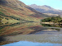 Loch Iubhair near Crianlarich | |
|---|---|
| Pro Lege et Libertate (For law and liberty) | |
| |
| [Interactive map] | |
| Area: | 2,493 square miles |
| Population: | 156,371 |
| County town: | Perth |
| County flower: | Alpine gentian [1] |
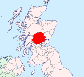
The County of Perth is a shire in central Scotland. In the midst of the land, its outlet to the sea is the Firth of Tay, and most of the towns lie near that river. The shire however extends far into the mountains to the north, and Perthshire is bounded and surrounded by nine counties, which may be told anti-clockwise from the Tay, Angus, Aberdeenshire, Inverness-shire (to the north), Argyll (to the west), Dunbartonshire, and to the south Stirlingshire, Clackmannanshire, Kinross-shire and Fife.
The county extends from Strathmore in the east, to the Pass of Drumochter in the north, Rannoch Moor and Ben Lui in the west, and Aberfoyle in the south.
Perthshire is known as the "big county", not so much for its size (though there are but six shires in the kingdom larger), as for the amount fitted in, as to unparalleled variety of towns and countryside. Its landscape includes the gentle coast, industry, rich agricultural straths in the east, to the high mountains of the southern Highlands, a world away from the polite towns of Strathearn.
The parishes of Culross and Tulliallan form an extensive detached part of Perthshire south of the main body, bounded by Clackmannanshire and Fife. Three other detached parts exist, one in the vicinity of Kippen in Stirlingshire and two in Angus, one of which is formed by Broughty Castle.
Landscape
Perthshire is generally considered to be in between the Highlands and the Lowlands of Scotland. Its county town Perth is often referred to as 'the gateway to the Highlands' with the part of Perthshire north of Perth referred to as 'Highland Perthshire'.
By far the greater part of the county is mountainous. The district of Breadalbane in the north of Perthshire contains lofty peaks and glittering rivers. Here the River Tay rises in several burns which join in the great Loch Tay from which the River Tay emerges.
Three major inland routes through the Highlands cut through Perthshire: the road from Perth to Strathspey (now the A9) by way of Pitlochry, that from Perth to Braemar and the River Dee, Aberdeenshire (the A93), while in the west of the county Crianlarich is the dramatic meeting point of the A82 and A85.
Strathearn in the south is the valley of the River Earn from Loch Earn to the Tay estuary; a gentler land of farms and modest towns.
The wee island of Mugdrum in the Firth of Tay belongs to Perthshire too.
The Moor of Rannoch on the borders of Argyllshire is a sterile, boulder-strewn waste, and Flanders Moss, to the south-east of Lake Menteith, is a vast boggy tract, which local man have struggled to subdue to cultivation.
Sir Walter Scott wrote of the county in The Fair Maid of Perth in 1828, "Amid all the provinces in Scotland if an intelligent stranger were asked to describe the most varied and the most beautiful it is probable he would name the county of Perth. A native also of any other district of Caledonia though his partialities might lead him to prefer his native county in the first instance would certainly class that of Perth in the second, and thus give its inhabitants a fair right to plead that—prejudice apart—Perthshire forms the fairest portion of the northern kingdom."[1]
Geology
The Highland portion of Perthshire is built up of a great series of schists and metamorphosed rocks grouped as Dalradian or Eastern schists, cut off from the Old Red Sandstone, which occupies most of the remainder of the county, by the great fault which traverses the county somewhat to the north of Aberfoyle and Crieff. Near the fault line the Highland schists are less metamorphosed than they are farther north; about Comrie and Callander they consist of shales, greywackes and igneous rocks with radiolarian cherts and black shales. Granite masses appear in amid the schists, as at Loch Rannoch, Loch Ericht and Glen Tilt.
The Old Red Sandstone consists in the lower portion mainly of coarse volcanic agglomerates and lava flows followed by conglomerates, sandstones and marls. The lowest beds are exposed along the crest of the Ochil Hills which, like the Sidlaw Hills are anticlinal in structure. The sandstone is well exposed near the Bridge of Earn and it extends beneath the marine platform of the Carse of Gowrie.
Old high level marine beaches form terraces far up several of the larger streams, and the Carse of Gowrie is formed by the beach at the 50-foot. level. The gravel cones poured out at the mouths of many of the glens which open on the south of the Ochils on to the 100-foot. or 50-foot beaches are often the site of villages.
Mountains
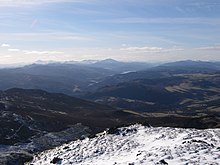
Including the hills on the confines of Inverness-shire and Argyllshire, there are at least fifty mountains exceeding 3,000 feet in height. Of these the best known are:
- Ben Lawers (3,984 feet) near Loch Tay
- Ben Mhor (3,843) east of Crianlarich
- Ben Lui (3,708 feet) on the Argyllshire border
- Beinn a' Ghlò (3,704 feet) in the Forest of Atholl
- Schiehallion (3,547 feet) south of Loch Rannoch
- Ben Vorlich (3,232 feet) by Loch Earn
- Ben Vannoch (3,125 feet) west of Loch Lyon
- Ben Chonzie (3,048 feet) near the head of Glen Almond.
Rivers
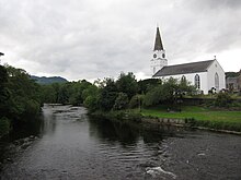
The principal river of Perthshire is the River Tay, on whose banks Perth stands, just as the river is opening out into its estuary, the Firth of Tay. Many small towns are found on the course of the Tay above Perth.
Smaller rivers include:
Glens and straths
History
The Romans came this way: in AD 83, Agricola campaigned victoriously beyond the Forth and in the next year penetrated far to the north, defeating the Caledonians under Calgacus at Mons Graupius; the site of this battle is unknown but Skene thought it to have been fought near Meikleour, south of Blairgowrie, while other writers have placed it further north. At Ardoch are the most perfect remains of a Roman encampment in the British Isles. Ultimately the Caledonians were left to themselves. According to Ptolemy, Perthshire was occupied by three tribes the Damnonii, the Venicones and the Vacomagi. The boldness of the Picts brought the Romans north once more under the Emperor Severus in 208; he reached the shores of the Moray Firth but was unable effectually to subdue the tribesmen. When the Romans finally withdrew from Britain, the Picts established their capital first at Abernethy and then at Forteviot. Abernethy was the centre of the Celtic church after the conversion of the natives by Ninian, Palladius and other missionaries in the 5th and 6th centuries.
The Norse burnt Forteviot in the 8th century and the Pictish capital was removed to Scone. In the latter half of the 9th century Dunkeld to which Kenneth Macalpine had brought some of the relics of Columba from Iona became the scene of monastic activity, the abbot succeeding to the position of the abbot of lona, and exercising great influence for nearly a hundred years.
In 1054, in events made famous by Shakespeare, King Macbeth was defeated at Dunsinane by Siward, Earl of Northumberland, who had invaded Scotland in the interest of his kinsman, Malcolm, King Duncan's son. Three years later, Malcolm took the throne as Malcolm III and the centre of the kingdom began to move to the English-speaking lands of the south. Nevertheless, up to the days of King Charles II, the Kings of Scots were crowned at Scone in Perthshire. Perth succeeded Scone as the capital of Scotland from the twelfth century.
King Edward I of England came to Perthshire and removed of the Coronation Stone from Scone to Westminster in 1296. The shire has long been a battleground: Robert Bruce defeated at Methven in 1306, his son at Dupplin Moor in 1332, Dundee's brief victory at Killiecrankie in 1689 and the indecisive contest at Sheriffmuir in the rebellion of 1715.
In quieter days, Perthshire settled into prosperity, Perth becoming a centre for modest industry and academia. The Victorian era and the coming the new roads and railways brought Perthshire to the attention of visitors and new mountain centres opened, and still prosper, in the shire's wilder places, as Braemar.
Towns and villages
Cities
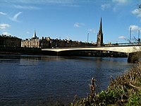
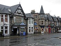
Besides the county town, Perth, other towns and villages in Perthshire include:
Other towns and villages
Parishes
- Aberdalgie
- Aberfoyle
- Abernethy†
- Abernyte
- Alyth*
- Ardoch
- Arngask#
- Auchterarder
- Auchtergaven
- Balquhidder
- Bendochy
- Blackford
- Blair Atholl
- Blairgowrie
- Callander
- Caputh
- Cargill
- Clunie
- Collace
- Comrie
- Coupar Angus*
- Crieff
- Dron
- Dull
- Dunbarney
- Dunblane and Lecropt
- Dunkeld and Dowally
- Dunning
- Errol
- Findo Gask
- Forgandenny
- Forteviot‡
- Fortingall
- Fossoway‡
- Fowlis Easter
- Fowlis Wester
- Glendevon
- Inchture
- Kenmore
- Killin
- Kilmadock
- Kilspindie
- Kincardine
- Kinclaven
- Kinfauns
- Kinloch
- Kinnaird
- Kinnoull
- Kirkmichael
- Lethendy
- Little Dunkeld
- Logie§
- Logiealmond
- Logierait
- Longforgan
- Madderty
- Meigle
- Methven
- Moneydie
- Monzievaird and Strowan
- Moulin
- Muckhart
- Muthill
- Perth
- Port of Menteith
- Rattray
- Redgorton
- Rhynd
- Scone
- St Madoes
- St Martins
- Tibbermore
- Trinity Gask
- Weem
*: Extends into Angus.
†: Extends into Fife.
‡: Extends into Kinross-shire.
§: Extends into Stirlingshire.
#: Extends into Fife and Kinross-shire.
Additionally the parish of Kippen, otherwise in Stirlingshire and a small angle of Newburgh, otherwise in Fife extend into Perthshire.
Sights of Perthshire
- Falls of Dochart
- Birnam Wood, famous from Shakespeare's Macbeth
 Blair Castle
 Drummond Castle
 Dunkeld Cathedral
- Four-poster stone formations near Strathtay and Strathmore
- Dunsinane Hill, a hill fort (likewise in Macbeth)
- Falls of Lochay
- Glen Dochart
- Gleneagles Hotel
- Glenfinglas
- Lake of Menteith
- Lecropt Kirk
- Loch Achray
- Loch Ard
- Loch Earn
- Loch Katrine (Source Glasgow's drinking water)
- Loch Rusky
- Loch Venachar
- Moirlanich Longhouse, Killin
- Rattray Norse ship-barrow
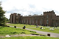
- Scone Palace
- The West Highland Way
- The witch-stone near Cairnbeddie
- Standing stones near Pitlochry
- Pitlochry Fishladder
Outside links
- Perth 800
- "Perthshire" from A Topographical Dictionary of Scotland by Samuel Lewis, London, 1846 (British History Online
References
| Counties of the United Kingdom |
|---|
|
Aberdeen • Anglesey • Angus • Antrim • Argyll • Armagh • Ayr • Banff • Bedford • Berks • Berwick • Brecknock • Buckingham • Bute • Caernarfon • Caithness • Cambridge • Cardigan • Carmarthen • Chester • Clackmannan • Cornwall • Cromarty • Cumberland • Denbigh • Derby • Devon • Dorset • Down • Dumfries • Dunbarton • Durham • East Lothian • Essex • Fermanagh • Fife • Flint • Glamorgan • Gloucester • Hants • Hereford • Hertford • Huntingdon • Inverness • Kent • Kincardine • Kinross • Kirkcudbright • Lanark • Lancaster • Leicester • Lincoln • Londonderry • Merioneth • Middlesex • Midlothian • Monmouth • Montgomery • Moray • Nairn • Norfolk • Northampton • Northumberland • Nottingham • Orkney • Oxford • Peebles • Pembroke • Perth • Radnor • Renfrew • Ross • Roxburgh • Rutland • Selkirk • Shetland • Salop • Somerset • Stafford • Stirling • Suffolk • Surrey • Sussex • Sutherland • Tyrone • Warwick • West Lothian • Westmorland • Wigtown • Wilts • Worcester • York |