Hardwicke, Tewkesbury: Difference between revisions
Jump to navigation
Jump to search
Created page with "{{Infobox town |name=Harescombe |county=Gloucestershire |picture= |picture caption= |os grid ref=SO908274 |latitude=51.945075 |longitude=-2.134496 |population= |census year=..." |
No edit summary |
||
| (One intermediate revision by one other user not shown) | |||
| Line 1: | Line 1: | ||
{{Infobox town | {{Infobox town | ||
|name= | |name=Hardwicke | ||
|county=Gloucestershire | |county=Gloucestershire | ||
|picture= | |picture=By Green Farm, Hardwick, Tewkesbury, Gloucestershire - geograph-1840174.jpg | ||
|picture caption= | |picture caption=By Green Farm, Hardwick | ||
|os grid ref=SO908274 | |os grid ref=SO908274 | ||
|latitude=51.945075 | |latitude=51.945075 | ||
Latest revision as of 20:51, 10 February 2020
| Hardwicke | |
| Gloucestershire | |
|---|---|
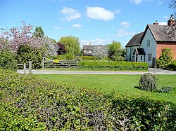
 By Green Farm, Hardwick | |
| Location | |
| Grid reference: | SO908274 |
| Location: | 51°56’42"N, 2°8’4"W |
| Data | |
| Postcode: | GL51 |
| Dialling code: | 01452 |
| Local Government | |
| Council: | Tewkesbury |
| Parliamentary constituency: |
Tewkesbury |
Hardwicke is a little village in the Vale of Gloucester in Gloucestershire, to the south of Tewkesbury and north-west of Cheltenham. The M5 motorway carves its way through the Vale immediately east of the village (with junction 10, for Cheltenham just a mile south of Hardwicke).

This Gloucestershire article is a stub: help to improve Wikishire by building it up.