Difference between revisions of "Loch Fad"
From Wikishire
(Created page with "Loch Fad on the Isle of Bute {{county|Buteshire}} '''Loch Fad''' is a freshwater loch on the Isle of...") |
|||
| (One intermediate revision by the same user not shown) | |||
| Line 3: | Line 3: | ||
'''Loch Fad''' is a freshwater loch on the [[Isle of Bute]], the northern main island of [[Buteshire]]. | '''Loch Fad''' is a freshwater loch on the [[Isle of Bute]], the northern main island of [[Buteshire]]. | ||
| − | The loch is a ribbon of water slices from north to south across the heart of the island, lying within the glen formed by the [[Highland Boundary Fault]], which is marked also by [[Rothesay Bay]] beyond its northern end and in a continuation of the line to the south-south-west by [[Loch Quien]] and then by [[Scalpsie Bay]]. The name 'Loch Fad' is from the Gaelic for "long loch", appropriately. | + | The loch is a ribbon of water which slices from north to south across the heart of the island, lying within the glen formed by the [[Highland Boundary Fault]], which is marked also by [[Rothesay Bay]] beyond its northern end and in a continuation of the line to the south-south-west by [[Loch Quien]] and then by [[Scalpsie Bay]]. The name 'Loch Fad' is from the Gaelic for "long loch", appropriately. |
Though the loch is within the constraints of a thin island, its surface area of 175 acres, which is fairly large for a freshwater loch on an island. From its foot flows a burn which runs northwards to the sea in [[Rothesay]], the island's main village and the [[county town]]. | Though the loch is within the constraints of a thin island, its surface area of 175 acres, which is fairly large for a freshwater loch on an island. From its foot flows a burn which runs northwards to the sea in [[Rothesay]], the island's main village and the [[county town]]. | ||
| Line 10: | Line 10: | ||
*Location map: {{wmap|55.806|-5.074}} | *Location map: {{wmap|55.806|-5.074}} | ||
| − | + | [[Category:Lochs of Buteshire|Fad]] | |
| − | [[Category:Lochs of Buteshire]] | + | [[Category:Highland Boundary Fault]] |
Latest revision as of 23:50, 14 January 2018
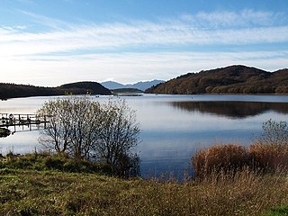
Loch Fad is a freshwater loch on the Isle of Bute, the northern main island of Buteshire.
The loch is a ribbon of water which slices from north to south across the heart of the island, lying within the glen formed by the Highland Boundary Fault, which is marked also by Rothesay Bay beyond its northern end and in a continuation of the line to the south-south-west by Loch Quien and then by Scalpsie Bay. The name 'Loch Fad' is from the Gaelic for "long loch", appropriately.
Though the loch is within the constraints of a thin island, its surface area of 175 acres, which is fairly large for a freshwater loch on an island. From its foot flows a burn which runs northwards to the sea in Rothesay, the island's main village and the county town.
Location
- Location map: 55°48’22"N, 5°4’26"W
