Fenton, Nottinghamshire: Difference between revisions
Jump to navigation
Jump to search
Created page with "{{Infobox town |name=Fenton |county=Nottinghamshire |picture=Pump Lane, Fenton - geograph.org.uk - 389682.jpg |picture caption=Pump Lane, Fenton |os grid ref=SK791830 |latitud..." |
No edit summary |
||
| Line 15: | Line 15: | ||
|constituency= | |constituency= | ||
}} | }} | ||
'''Fenton''' is a hamlet in [[Nottinghamshire]] about five and a half miles east of [[Retford]], halfway between two villages: [[Sturton le Steeple]] half a mile to the north and the doubly named village [[North | '''Fenton''' is a hamlet in [[Nottinghamshire]] about five and a half miles east of [[Retford]], halfway between two villages: [[Sturton le Steeple]] half a mile to the north and the doubly named village [[North Leverton with Habblethorpe]]. | ||
==Outside links== | ==Outside links== | ||
{{Commons}} | {{Commons}} | ||
Latest revision as of 12:58, 13 July 2017
| Fenton | |
| Nottinghamshire | |
|---|---|
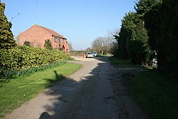
 Pump Lane, Fenton | |
| Location | |
| Grid reference: | SK791830 |
| Location: | 53°20’18"N, -0°48’47"W |
| Data | |
| Postcode: | DN22 |
| Local Government | |
Fenton is a hamlet in Nottinghamshire about five and a half miles east of Retford, halfway between two villages: Sturton le Steeple half a mile to the north and the doubly named village North Leverton with Habblethorpe.
Outside links
| ("Wikimedia Commons" has material about Fenton, Nottinghamshire) |
