Oxwich Bay: Difference between revisions
Created page with "right|thumb|300px|Oxwich Bay {{county|Glamorgan}} '''Oxwich Bay''' is a bay on the south coast of the Gower Peninsula in Glamorgan. ..." |
|||
| Line 15: | Line 15: | ||
==Outside links== | ==Outside links== | ||
*Map: {{map|SS513874}} | *Map: {{map|SS513874}} | ||
*Location map: {{wmap|51.56581|-4.14679}} | *Location map: {{wmap|51.56581|-4.14679|zoom=14}} | ||
*[http://www.forces-of-nature.co.uk/dbdriven/beachguide/beachguide.php?action=display_location&loc_id=29 Forces of Nature: Oxwich Bay: Beach information] | *[http://www.forces-of-nature.co.uk/dbdriven/beachguide/beachguide.php?action=display_location&loc_id=29 Forces of Nature: Oxwich Bay: Beach information] | ||
*[http://www.thegowercoast.com/beaches/oxwich_bay '''Oxwich'''] | *[http://www.thegowercoast.com/beaches/oxwich_bay '''Oxwich'''] | ||
Latest revision as of 19:35, 25 March 2015

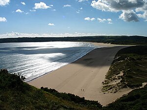
Oxwich Bay is a bay on the south coast of the Gower Peninsula in Glamorgan.
Its landscape features sand dunes, salt marshes and woodland. Oxwich Bay includes a 2.5-mile long sandy beach, accessible from the village of Oxwich. It is a popular spot for swimming and watersports including diving, sailing, water skiing and windsurfing. There is a public footpath along the cliffs from Oxwich Bay, around Oxwich Point, and to Port Eynon Bay.
A wetland site at the rear of the dunes forms Oxwich Burrows National Nature Reserve.[1] The dunes are crossed by a small stream called Nicholaston Pill. The bay ends at the eastern end with the cliffs of High Tor; but at low tide, a continuous sandy beach connects with Three Cliffs Bay beyond.
Submarine cables leave the mainland of Britain from Oxwich. These include the SOLAS cable across the Irish Sea, and the TAT-11 and Gemini North transatlantic telephone cables. These latter two do not terminate here but instead continue on to France (TAT-11) and Devon (Gemini).
Buses run every couple of hours between Oxwich and Port Eynon.
On 1 February 2007, The Travel Magazine named Oxwich beach the most beautiful in Britain.[2]
Outside links
- Map: SS513874
- Location map: 51°33’57"N, 4°8’48"W
- Forces of Nature: Oxwich Bay: Beach information
- Oxwich
- Pictures of Oxwich Bay and the area on Geograph.co.uk
- Landslide at Oxwich Bay December 2009 British Geological Survey