Glastonbury: Difference between revisions
Created page with '{{Infobox town |county=Somerset |picture=glastonbury (part of) from the tor arp.jpg |picture caption=Glastonbury from the Tor |os grid ref=ST501390 |latitude=51.1485 |longitude=-…' |
mNo edit summary |
||
| (4 intermediate revisions by 2 users not shown) | |||
| Line 16: | Line 16: | ||
'''Glastonbury''' is a small town in [[Somerset]], at a dry point on the low-lying [[Somerset Levels]], 23 miles south of [[Bristol]]. A mile away across the [[River Brue]] is the village of [[Street, Somerset|Street]]. At the edge of the town and dominating landscape for many miles around is [[Glastonbury Tor]]; a solitary hill rising straight from the Levels, atop which stands a ruined mediæval chapel. At the foot of the Tor are the ruins of Glastonbury Abbey, around which the town grew from the Early Middle Ages to the Reformation. | '''Glastonbury''' is a small town in [[Somerset]], at a dry point on the low-lying [[Somerset Levels]], 23 miles south of [[Bristol]]. A mile away across the [[River Brue]] is the village of [[Street, Somerset|Street]]. At the edge of the town and dominating landscape for many miles around is [[Glastonbury Tor]]; a solitary hill rising straight from the Levels, atop which stands a ruined mediæval chapel. At the foot of the Tor are the ruins of Glastonbury Abbey, around which the town grew from the Early Middle Ages to the Reformation. | ||
Glastonbury is within the Glaston Twelve Hides Hundred. | Glastonbury is within the [[Glaston Twelve Hides]] Hundred. | ||
Glastonbury today is a truly bizarre place. It was once a quiet, respectable Somerset town, and indeed most of the townsfolk would have it so, but a pair of idle mediæval legends attached to the town have grown into a vast "New Age" industry. The town has been described as a New Age community; it attracts people with New Age and Neopagan beliefs, drawn by myths ancient and newly made, concerning Joseph of Arimathea and King Arthur, which merge into those of the Holy Grail. | Glastonbury today is a truly bizarre place. It was once a quiet, respectable Somerset town, and indeed most of the townsfolk would have it so, but a pair of idle mediæval legends attached to the town have grown into a vast "New Age" industry. The town has been described as a New Age community; it attracts people with New Age and Neopagan beliefs, drawn by myths ancient and newly made, concerning Joseph of Arimathea and King Arthur, which merge into those of the Holy Grail. | ||
| Line 24: | Line 24: | ||
==The town== | ==The town== | ||
[[File:Glastonbury High street.jpg|right|thumb|200px|The High Street]] | [[File:Glastonbury High street.jpg|right|thumb|200px|The High Street]] | ||
Glastonbury is a busting small town of the [[Somerset Levels]]. As with many towns of similar size, the centre is not as thriving as it once was but Glastonbury serves a large number of visitors, both | Glastonbury is a busting small town of the [[Somerset Levels]]. As with many towns of similar size, the centre is not as thriving as it once was but Glastonbury serves a large number of visitors, both conventional daytrippers and holidaymakers and those of an alternative lifestyle. It supports a large number of "alternative" shops. | ||
In the Middle Ages, Glastonbury was a place of pilgrimage, home to one of the richest abbeys in Britain and many of the oldest surviving buildings in the town, including the Tribunal, George Hotel and Pilgrims' Inn and the Somerset Rural Life Museum, which is based in an old tithe barn, are associated with the Abbey. The Abbey was dissolved and pilgrimage put down at the Reformation the idea of Christian pilgrimage, Anglican and Roman Catholic, has revived here. It is also a large centre for religious tourism and neo-pagan pilgrimage. For the latter there are countless unusual shops and visitor attractions in the town. | In the Middle Ages, Glastonbury was a place of pilgrimage, home to one of the richest abbeys in Britain and many of the oldest surviving buildings in the town, including the Tribunal, George Hotel and Pilgrims' Inn and the Somerset Rural Life Museum, which is based in an old tithe barn, are associated with the Abbey. The Abbey was dissolved and pilgrimage put down at the Reformation the idea of Christian pilgrimage, Anglican and Roman Catholic, has revived here. It is also a large centre for religious tourism and neo-pagan pilgrimage. For the latter there are countless unusual shops and visitor attractions in the town. | ||
| Line 88: | Line 88: | ||
*Roman Catholic: [http://www.glastonburyshrine.co.uk/ St Mary's R C Church] | *Roman Catholic: [http://www.glastonburyshrine.co.uk/ St Mary's R C Church] | ||
The Church of St Benedict was rebuilt by Abbot Richard Beere in about 1520.<ref>{{ | The Church of St Benedict was rebuilt by Abbot Richard Beere in about 1520.<ref>{{NHLE|1057966|Church of St Benedict}}</ref> | ||
The Church of St John the Baptist dates from the 15th century and has been designated as a Grade I listed building.<ref>{{cite web|url=http://webapp1.somerset.gov.uk/her/details.asp?prn=20585|title=Church of St John the Baptist, High Street (North side), Glastonbury|work=Somerset Historic Environment Record|publisher=Somerset County Council|accessdate=18 May 2009}}</ref> The church is laid out in a cruciform plan with an aisled nave and a clerestorey of seven bays. The west tower has elaborate buttressing, panelling and battlements. The interior of the church includes four 15th-century tomb-chests, some 15th-century stained glass in the chancel, mediæval vestments, and a domestic cupboard of about 1500 which was once at Witham Charterhouse.<ref>{{ | The Church of St John the Baptist dates from the 15th century and has been designated as a Grade I listed building.<ref>{{cite web|url=http://webapp1.somerset.gov.uk/her/details.asp?prn=20585|title=Church of St John the Baptist, High Street (North side), Glastonbury|work=Somerset Historic Environment Record|publisher=Somerset County Council|accessdate=18 May 2009}}</ref> The church is laid out in a cruciform plan with an aisled nave and a clerestorey of seven bays. The west tower has elaborate buttressing, panelling and battlements. The interior of the church includes four 15th-century tomb-chests, some 15th-century stained glass in the chancel, mediæval vestments, and a domestic cupboard of about 1500 which was once at Witham Charterhouse.<ref>{{NHLE|1345459|Church of St John the Baptist}}</ref> | ||
The United Reformed Church on the High Street was built in 1814 and altered in 1898. It stands on the site of the Ship Inn where meetings were held during the 18th century. It is Grade II listed.<ref>{{ | The United Reformed Church on the High Street was built in 1814 and altered in 1898. It stands on the site of the Ship Inn where meetings were held during the 18th century. It is Grade II listed.<ref>{{NHLE|1057939|Congregational Church}}</ref> | ||
==Glastonbury Abbey== | ==Glastonbury Abbey== | ||
[[File:Glastonbury Abbey 03.jpg|right|thumb|200px|Ruins of Glastonbury Abbey]] | [[File:Glastonbury Abbey 03.jpg|right|thumb|200px|Ruins of Glastonbury Abbey]] | ||
The remains of Glastonbury Abbey lie in the middle of town; once the dominant presence in the area, it is now a ruin and tourist attraction. Unlike some other dissolved abbeys in towns, its chapel was not preserved as a town church. The remains of the Abbot's Kitchen (a Grade I listed building.<ref>{{cite web | title=Abbot's Kitchen, Glastonbury Abbey | work=Images of England | url=http://www.imagesofengland.org.uk/details/default.aspx?id=265971 | accessdate=11 November 2006}}</ref>) and the Lady Chapel are particularly well-preserved set in 36 acres of parkland. It is approached by the Abbey Gatehouse which was built in the mid-14th century and completely restored in 1810.<ref>{{ | The remains of Glastonbury Abbey lie in the middle of town; once the dominant presence in the area, it is now a ruin and tourist attraction. Unlike some other dissolved abbeys in towns, its chapel was not preserved as a town church. The remains of the Abbot's Kitchen (a Grade I listed building.<ref>{{cite web | title=Abbot's Kitchen, Glastonbury Abbey | work=Images of England | url=http://www.imagesofengland.org.uk/details/default.aspx?id=265971 | accessdate=11 November 2006}}</ref>) and the Lady Chapel are particularly well-preserved set in 36 acres of parkland. It is approached by the Abbey Gatehouse which was built in the mid-14th century and completely restored in 1810.<ref>{{NHLE|1345446|title=Abbey Gatehouse, including the porters' lodge|accessdate=18 August 2008}}</ref> | ||
==Myths and legends== | ==Myths and legends== | ||
| Line 134: | Line 134: | ||
===Glastonbury zodiac=== | ===Glastonbury zodiac=== | ||
In 1934 artist Katherine Maltwood suggested a landscape zodiac, a map of the stars on a gigantic scale, formed by features in the landscape such as roads, streams and field boundaries, could be found situated around Glastonbury. <ref>Maltwood, K. E. ''A Guide to Glastonbury's Temple of the Stars: Their Giant Effigies Described From Air Views, Maps, and From "The High History of the Holy Grail"'' (London, The Women's Printing Society, Ltd., 1934). Her next book on the subject matter, ''Air View Supplement To A Guide To Glastonbury's Temple of The Stars'' was published in 1937.</ref> She held that the "temple" was created by Sumerians about 2700 BC. The idea of a prehistoric landscape zodiac was eagerly seized upon by the fashionable neo-pagans of the age and has appeared in endless books since then, still promoted by the New Age community around the town. | In 1934 artist Katherine Maltwood suggested a landscape zodiac, a map of the stars on a gigantic scale, formed by features in the landscape such as roads, streams and field boundaries, could be found situated around Glastonbury.<ref>Maltwood, K. E. ''A Guide to Glastonbury's Temple of the Stars: Their Giant Effigies Described From Air Views, Maps, and From "The High History of the Holy Grail"'' (London, The Women's Printing Society, Ltd., 1934). Her next book on the subject matter, ''Air View Supplement To A Guide To Glastonbury's Temple of The Stars'' was published in 1937.</ref> She held that the "temple" was created by Sumerians about 2700 BC. The idea of a prehistoric landscape zodiac was eagerly seized upon by the fashionable neo-pagans of the age and has appeared in endless books since then, still promoted by the New Age community around the town. | ||
In 1975 Ian Burrow, a local archaeologist, was bestirred to examine the claims<ref> | In 1975 Ian Burrow, a local archaeologist, was bestirred to examine the claims<ref>[http://sites.google.com/site/alisonsinc/maltwood'szodiac Ian Burrow, Somerset's Planning Department staff archeologist]</ref> and concluded that "while the outlines of the effigies may be plotted today, their antiquity is illusory". In 1983 Tom Williamson and Liz Bellamy did so<ref>Tom Williamson, Liz Bellamy, ''Ley Lines In Question'', pages 162-168. (Tadworth, UK: World's Work, 1983). ISBN 0437192059</ref> and disproved Maltwood's ideas. The eye of "Capricorn" identified by Maltwood was a haystack. The western wing of the "Aquarius" was a road laid in 1782 to run around Glastonbury, and older maps dating back to the 1620s show the road had no predecessors. "Cancer", plotted as a boat not a crab, was a network of 18th-century drainage ditches and paths. Of the genuine Neolithic paths preserved in the peat of the bog formerly comprising most of the area, none matches the lines of the "zodiac" features. | ||
==Geography== | ==Geography== | ||
| Line 142: | Line 142: | ||
The walk up [[Glastonbury Tor]] to the ruined church at the summit is rewarded by a far view across the Levels and the heart of Somerset. From there it is easy to appreciate how Glastonbury was once an island and, in the winter, the surrounding moors are often flooded, giving that appearance once more. | The walk up [[Glastonbury Tor]] to the ruined church at the summit is rewarded by a far view across the Levels and the heart of Somerset. From there it is easy to appreciate how Glastonbury was once an island and, in the winter, the surrounding moors are often flooded, giving that appearance once more. | ||
It is an agricultural region typically with open fields of permanent grass, surrounded by ditches with willow trees. Access to the moors and Levels is by "droves". The Levels and inland moors can be 20 feet below peak tides and have large areas of peat. The low lying areas are underlain by much older Triassic age formations of Upper Lias sand that protrude to form what would once have been islands and include Glastonbury Tor.<ref name="natengsomerset">{{cite web |url=http://www.english-nature.org.uk/special/geological/sites/area_ID30.asp |title=Somerset |accessdate=10 June 2007 |work=Natural England }}</ref><ref name="ncprofile">{{cite web |url=http://www.english-nature.org.uk/science/natural/profiles/naProfile85.pdf |title=Somerset Levels and Moors Natural Area – A nature conservation profile July 1997|accessdate=10 June 2007 |format=PDF |work=English Nature }}</ref> The lowland landscape was formed only during the last 10,000 years, following the end of the last ice age.<ref>{{cite book |last=Hardy |first=Peter |title=The Geology of Somerset |year=1999 |publisher=Ex Libris Press |location=Bradford on Avon |isbn=0948578424 | pages=185–186 }}</ref> | It is an agricultural region typically with open fields of permanent grass, surrounded by ditches with willow trees. Access to the moors and Levels is by "droves". The Levels and inland moors can be 20 feet below peak tides and have large areas of peat. The low-lying areas are underlain by much older Triassic age formations of Upper Lias sand that protrude to form what would once have been islands and include Glastonbury Tor.<ref name="natengsomerset">{{cite web |url=http://www.english-nature.org.uk/special/geological/sites/area_ID30.asp |title=Somerset |accessdate=10 June 2007 |work=Natural England }}</ref><ref name="ncprofile">{{cite web |url=http://www.english-nature.org.uk/science/natural/profiles/naProfile85.pdf |title=Somerset Levels and Moors Natural Area – A nature conservation profile July 1997|accessdate=10 June 2007 |format=PDF |work=English Nature }}</ref> The lowland landscape was formed only during the last 10,000 years, following the end of the last ice age.<ref>{{cite book |last=Hardy |first=Peter |title=The Geology of Somerset |year=1999 |publisher=Ex Libris Press |location=Bradford on Avon |isbn=0948578424 | pages=185–186 }}</ref> | ||
The low lying damp ground can produce a visual effect known as a Fata Morgana. This optical phenomenon occurs because rays of light are strongly bent when they pass through air layers of different temperatures in a steep thermal inversion where an atmospheric duct has formed.<ref>{{cite web|last=Young|first=Andrew|title=An Introduction to Mirages|url=http://mintaka.sdsu.edu/GF/mirages/mirintro.html|publisher=San Diego State University|accessdate=5 July 2010}}</ref> The Italian name ''Fata Morgana'' is derived from the name of Morgan le Fay, who was alternatively known as Morgane, Morgain, Morgana and other variants. Morgan le Fay was described as a powerful sorceress and antagonist of King Arthur and Queen Guinevere in the Arthurian legend. | The low lying damp ground can produce a visual effect known as a Fata Morgana. This optical phenomenon occurs because rays of light are strongly bent when they pass through air layers of different temperatures in a steep thermal inversion where an atmospheric duct has formed.<ref>{{cite web|last=Young|first=Andrew|title=An Introduction to Mirages|url=http://mintaka.sdsu.edu/GF/mirages/mirintro.html|publisher=San Diego State University|accessdate=5 July 2010}}</ref> The Italian name ''Fata Morgana'' is derived from the name of Morgan le Fay, who was alternatively known as Morgane, Morgain, Morgana and other variants. Morgan le Fay was described as a powerful sorceress and antagonist of King Arthur and Queen Guinevere in the Arthurian legend. | ||
| Line 148: | Line 148: | ||
Glastonbury is less than a mile across the [[River Brue]] from the village of [[Street, Somerset|Street]]. | Glastonbury is less than a mile across the [[River Brue]] from the village of [[Street, Somerset|Street]]. | ||
Until the Levels were drained, the Brue formed a lake just south of the hilly ground on which Glastonbury stands. This lake is one of the locations suggested by Arthurian legend as the home of the Lady of the Lake. Pomparles Bridge stood at the western end of this lake, guarding Glastonbury from the south, and some versions of the legend suggest that it was here that Sir Bedivere threw Excalibur into the waters after King Arthur fell at the Battle of Camlann.<ref>{{cite web | title=Pomparles Bridge | work=ArthurianAdventure.com | url=http://www.arthurianadventure.com/pomparles_bridge.htm | accessdate=11 November 2008}}</ref> The old bridge was replaced by a reinforced concrete arch bridge in 1911.<ref>{{cite web|title=Pomparles Bridge, Northover, Glastonbury|url=http://webapp1.somerset.gov.uk/her/details.asp?prn=23577|work=Somerset Historic Environment Record|publisher=Somerset County Council|accessdate=4 July 2010}}</ref> | |||
Until the 13th century, the direct route to the sea at Highbridge was prevented by gravel banks and peat near Westhay.<ref>{{cite web | title=Meare and Ferran Mere | work=Sacred Sites around Glastonbury | url=http://www.isleofavalon.co.uk/sacredsites/meare.html | accessdate=1 November 2008}}</ref> The course of the river partially encircled Glastonbury from the south, around the western side (through Beckery), and then north through the [[Panborough]]-[[Bleadney]] gap in the [[Wedmore]]-[[Wookey]] Hills, to join the [[River Axe, Somerset|River Axe]] just north of Bleadney. This route made it difficult for the officials of Glastonbury Abbey to transport produce from their outlying estates to the abbey, and when the valley of the River Axe was in flood it backed up to flood Glastonbury itself. Some time between 1230 and 1250 a new channel was constructed westwards into Meare Pool north of [[Meare]], and further westwards to Mark Moor. The Brue Valley Living Landscape is a conservation project based on the Somerset Levels and Moors and managed by the Somerset Wildlife Trust.<ref name="Brue Valley living landscape">{{cite web|title=Brue Valley Living Landscape|url=http://www.somersetwildlife.org/brue_valley.html|publisher=Somerset Wildlife Trust|accessdate=2 July 2010}}</ref> The project commenced in January 2009 and aims to restore, recreate and reconnect habitat, ensuring that wildlife is enhanced and capable of sustaining itself in the face of climate change, while guaranteeing farmers and other landowners can continue to use their land profitably.<ref name="Brue Valley living landscape"/> It is one of an increasing number of landscape scale conservation projects in the United Kingdom.<ref>{{cite web|title=a living landscape|url=http://www.wildlifetrusts.org/?section=environment:livinglandscapes|publisher=Wildlife Trusts|accessdate=5 July 2010}}</ref><ref>{{cite web|url=http://www.rspb.org.uk/ourwork/farming/policy/landuse/landscape.asp|title=RSPB landscape conservation|publisher=Royal Society for the Protection of Birds|accessdate=5 July 2010}}</ref> | Until the 13th century, the direct route to the sea at Highbridge was prevented by gravel banks and peat near Westhay.<ref>{{cite web | title=Meare and Ferran Mere | work=Sacred Sites around Glastonbury | url=http://www.isleofavalon.co.uk/sacredsites/meare.html | accessdate=1 November 2008}}</ref> The course of the river partially encircled Glastonbury from the south, around the western side (through Beckery), and then north through the [[Panborough]]-[[Bleadney]] gap in the [[Wedmore]]-[[Wookey]] Hills, to join the [[River Axe, Somerset|River Axe]] just north of Bleadney. This route made it difficult for the officials of Glastonbury Abbey to transport produce from their outlying estates to the abbey, and when the valley of the River Axe was in flood it backed up to flood Glastonbury itself. Some time between 1230 and 1250 a new channel was constructed westwards into Meare Pool north of [[Meare]], and further westwards to Mark Moor. The Brue Valley Living Landscape is a conservation project based on the Somerset Levels and Moors and managed by the Somerset Wildlife Trust.<ref name="Brue Valley living landscape">{{cite web|title=Brue Valley Living Landscape|url=http://www.somersetwildlife.org/brue_valley.html|publisher=Somerset Wildlife Trust|accessdate=2 July 2010}}</ref> The project commenced in January 2009 and aims to restore, recreate and reconnect habitat, ensuring that wildlife is enhanced and capable of sustaining itself in the face of climate change, while guaranteeing farmers and other landowners can continue to use their land profitably.<ref name="Brue Valley living landscape"/> It is one of an increasing number of landscape scale conservation projects in the United Kingdom.<ref>{{cite web|title=a living landscape|url=http://www.wildlifetrusts.org/?section=environment:livinglandscapes|publisher=Wildlife Trusts|accessdate=5 July 2010}}</ref><ref>{{cite web|url=http://www.rspb.org.uk/ourwork/farming/policy/landuse/landscape.asp|title=RSPB landscape conservation|publisher=Royal Society for the Protection of Birds|accessdate=5 July 2010}}</ref> | ||
| Line 157: | Line 157: | ||
[[File:George Hotel and Pilgrims' Inn, Glastonbury.JPG|right|thumb|160px|George Hotel and Pilgrims' Inn]] | [[File:George Hotel and Pilgrims' Inn, Glastonbury.JPG|right|thumb|160px|George Hotel and Pilgrims' Inn]] | ||
*{{i-Abbey}} Glastonbury Abbey ruins | *{{i-Abbey}} Glastonbury Abbey ruins | ||
*{{i-Museum}} The Tribunal: a mediæval merchant's house, used as the Abbey courthouse and during the "Bloody Assizes" by Judge Jeffreys.<ref>{{ | *{{i-Museum}} The Tribunal: a mediæval merchant's house, used as the Abbey courthouse and during the "Bloody Assizes" by Judge Jeffreys.<ref>{{NHLE|1345457|The Tribunal|grade=I}}</ref> It now serves as a museum run by the Glastonbury Antiquarian Society.<ref>{{cite web|url=http://www.glastonburyantiquarians.org/site/index.php|title=Glastonbury Antiquarian Society|publisher=Glastonbury Antiquarian Society|accessdate=22 May 2009}}</ref> | ||
*Market Cross, an octagonal market cross built in 1846 by Benjamin Ferrey.<ref>{{ | *Market Cross, an octagonal market cross built in 1846 by Benjamin Ferrey.<ref>{{NHLE|1057910|Market Cross|Grade=II}}</ref> | ||
*The George Hotel and Pilgrims' Inn, built in the late 15th century to accommodate visitors to Glastonbury Abbey: a Grade I listed building.<ref>{{NHLE|1345455|George Hotel and Pilgrims' Inn}}</ref> The front of the 3-storey building is divided into 3 tiers of panels with traceried heads. Above these are 3 carved panels with arms of the Abbey and Edward IV. | |||
*{{i-Museum}} The Somerset Rural Life Museum: a museum of the social and agricultural history of Somerset, housed in buildings surrounding a 14th-century barn once belonging to Glastonbury Abbey, a Grade I listed building. | *{{i-Museum}} The Somerset Rural Life Museum: a museum of the social and agricultural history of Somerset, housed in buildings surrounding a 14th-century barn once belonging to Glastonbury Abbey, a Grade I listed building. | ||
*The Chalice Well: a well at the foot of the Tor which has been the subject of some of the local legends, Christian and pagan. It is covered by a wooden well-cover with wrought-iron decoration made in 1919. Water issues from the spring at a rate of 25,000 gallons a day and has never failed, even during drought. The well is about 9 feet deep, with two underground chambers at its bottom.<ref name=IOEChaliceWell>{{ | *The Chalice Well: a well at the foot of the Tor which has been the subject of some of the local legends, Christian and pagan. It is covered by a wooden well-cover with wrought-iron decoration made in 1919. Water issues from the spring at a rate of 25,000 gallons a day and has never failed, even during drought. The well is about 9 feet deep, with two underground chambers at its bottom.<ref name=IOEChaliceWell>{{NHLE|1167594|The Chalice Well|grade=I}}</ref> | ||
==Culture== | ==Culture== | ||
Latest revision as of 22:50, 5 October 2022
| Glastonbury | |
| Somerset | |
|---|---|
 Glastonbury from the Tor | |
| Location | |
| Grid reference: | ST501390 |
| Location: | 51°8’55"N, 2°42’50"W |
| Data | |
| Population: | 8,784 |
| Post town: | Glastonbury |
| Postcode: | BA6 |
| Dialling code: | 01458 |
| Local Government | |
| Council: | Mendip |
| Parliamentary constituency: |
Wells |
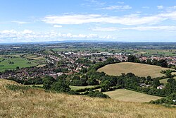
Glastonbury is a small town in Somerset, at a dry point on the low-lying Somerset Levels, 23 miles south of Bristol. A mile away across the River Brue is the village of Street. At the edge of the town and dominating landscape for many miles around is Glastonbury Tor; a solitary hill rising straight from the Levels, atop which stands a ruined mediæval chapel. At the foot of the Tor are the ruins of Glastonbury Abbey, around which the town grew from the Early Middle Ages to the Reformation.
Glastonbury is within the Glaston Twelve Hides Hundred.
Glastonbury today is a truly bizarre place. It was once a quiet, respectable Somerset town, and indeed most of the townsfolk would have it so, but a pair of idle mediæval legends attached to the town have grown into a vast "New Age" industry. The town has been described as a New Age community; it attracts people with New Age and Neopagan beliefs, drawn by myths ancient and newly made, concerning Joseph of Arimathea and King Arthur, which merge into those of the Holy Grail.
The Glastonbury Festival, held in the nearby village of Pilton, takes its name from the town.
The town
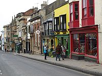
Glastonbury is a busting small town of the Somerset Levels. As with many towns of similar size, the centre is not as thriving as it once was but Glastonbury serves a large number of visitors, both conventional daytrippers and holidaymakers and those of an alternative lifestyle. It supports a large number of "alternative" shops.
In the Middle Ages, Glastonbury was a place of pilgrimage, home to one of the richest abbeys in Britain and many of the oldest surviving buildings in the town, including the Tribunal, George Hotel and Pilgrims' Inn and the Somerset Rural Life Museum, which is based in an old tithe barn, are associated with the Abbey. The Abbey was dissolved and pilgrimage put down at the Reformation the idea of Christian pilgrimage, Anglican and Roman Catholic, has revived here. It is also a large centre for religious tourism and neo-pagan pilgrimage. For the latter there are countless unusual shops and visitor attractions in the town.
The town became a centre for commerce, which led to the construction of the market cross, Glastonbury Canal and the Glastonbury and Street railway station, the largest station on the original Somerset and Dorset Joint Railway. The Brue Valley Living Landscape is a conservation project managed by the Somerset Wildlife Trust and nearby is the Ham Wall National Nature Reserve.
The outskirts of the town contain a DIY shop a former sheepskin and slipper factory site which is slowly being redevoped into a new light industrial park.[1][2] As part of the redevelopment of the site a project has been established by the Glastonbury Community Development Trust to provide support for local unemployed people applying for employment, starting in self-employment and accessing work-related training.[3]
Name of the town
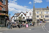
The name "Glastonbury" is first found in Old English, recorded in the 7th and the early 8th century as Glæstingaburg and Glestingaburg. The name means "town of the Glestingas", though who the "Glestingas" clan may have been is lost: the form suggests that it may derive from a personal name, whether English or British.
William of Malmesbury in his De Antiquitate Glastonie Ecclesie gives the Old Celtic Ineswitrin (or Ynys Witrin) as the town’s earliest name,[4] and asserts that the founder of the town was the eponymous Glast, a descendant of Cunedda, the famous king in late Roman Wales.[4]
History
Until modern times, the Somerset Levels were flooded for much of the year, and amongst this vast marsh Glastonbury, standing on a slight rise, was an island. The Tor rising majestically from the waters remains a landmark drawing the eye for many mailes around.
Prehistory
Evidence from timber trackways such as the Sweet Track west of Glastonbury show that the town has been inhabited since Neolithic times. The Sweet Trackis one of the oldest engineered roads known: it was the oldest timber trackway discovered in Northern Europe, until the 2009 discovery of a 6,000 year-old trackway in Belmarsh.[5] Tree-ring dating of the timbers has enabled very precise dating of the track, showing it was built in the 39th century BC: in 3807 or 3806 BC in fact.[6] It has been claimed to be the oldest road in the world.[7] The track was discovered in 1970 and is named after its discoverer, Ray Sweet.[8] It extended across the marsh between Westhay and a ridge of high ground at Shapwick, a distance of 2,000 yards, built of crossed poles of ash, oak and lime driven into the waterlogged soil to support a walkway that mainly consisted of oaken planks laid end-to-end. Trace of an even earlier track has been found now; the Post Track, dating from 3838 BC and so 30 years older.[9]
A Bronze Age village known as Glastonbury Lake Village has been dscovered close to the old course of the River Brue 2 miles west of Glastonbury.
Middle Ages
Glastonbury itself first appears in the records when King Ine of Wessex founded Glastonbury Abbey in the eighth century.[10] The Abbey dominated the town for the next 700 years. One of the most important abbeys in England, it was the site of Edmund Ironside's coronation as King of England in 1016. After his death later that year he was buried at the abbey.[11]
The Abbey Church was enlarged in the 10th century by the Abbot of Glastonbury, Dunstan, the central figure in the 10th-century revival of English monastic life. He instituted the Benedictine Rule at Glastonbury and built new cloisters. Dunstan became Archbishop of Canterbury in 960.
In the 1070s St Margaret's Chapel was built on Magdelene Street, originally as a hospital and later as almshouses for the poor. The current building dates from 1444.[12] The roof of the hall is thought to have been removed after the Dissolution, and some of the building was demolished in the 1960s. It is Grade II* listed.[13]
In 1184, a great fire at Glastonbury destroyed the monastic buildings. Reconstruction began almost immediately and the Lady Chapel, which includes the well, was consecrated in 1186.[14] King Eadwig granted Sharpham to the then abbot Æthelwold in 957. In 1191 Sharpham Park was conferred on the Abbey by Prince John, and the Abbey held the park and house until the dissolution of the monasteries in 1539.
During the Middle Ages, the town largely depended on the abbey but was also a centre for the wool trade until the 18th century. An Anglo-Saxon-era canal connected the abbey to the River Brue.
The Church of St John the Baptist dates from the 15th century.
During the Second Cornish Uprising of 1497 Perkin Warbeck surrendered when he heard that |Giles, Lord Daubeney's troops, loyal to King Henry VII were camped at Glastonbury.[15]
Early modern
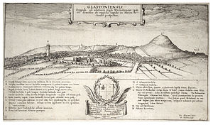
In 1539 the Abbey was dissolved. Richard Whiting, the last Abbot of Glastonbury, resisted and was executed with two of his monks on 15 November of that year.[16] Sharpham Park passed to Edward Seymour, brother of Queen Jane and later Duke of Somerset and Lord Protector to King Edward VI. The house is now a private residence and Grade II* listed building.[17] The Abbey buildings were progressively destroyed as their stones were removed for use in local building work.
In 1693 Glastonbury, Connecticut was founded and named after the Somerset town from which some of the settlers had emigrated. It was originally called "Glistening Town" until the mid-19th century when it was changed in line with Glastonbury, England. A representation of the Glastonbury thorn is incorporated onto the town seal.[18]
The Somerset towns charter of incorporation was received in 1705. Growth in the trade and economy largely depended on the drainage of the surrounding moors. The opening of the Glastonbury Canal produced an upturn in trade, and encouraged local building.
Modern times
By the middle of the 18th century the Glastonbury Canal drainage problems and competition from the new railways caused a decline in trade, and the town's economy became depressed. The canal was closed on 1 July 1854, and the lock and aqueducts on the upper section were dismantled. The railway opened on 17 August 1854.[19] The lower sections of the canal were given to the Commissioners for Sewers,[20] for use as a drainage ditch. The final section was retained to provide a wharf for the railway company, which was used until 1936, when it passed to the Commissioners of Sewers and was filled in.[19] The Central Somerset Railway merged with the Dorset Central Railway to become the Somerset and Dorset Railway.[21] The main line to Glastonbury closed in 1966.[19]
In the Northover district, the industrial manufacture of sheepskins, woollen slippers and, later, boots and shoes,[22] developed in conjunction with the growth of C&J Clark in Street. Clarks still has its headquarters in Street, but shoes are no longer manufactured there. Instead, in 1993, redundant factory buildings were converted to form Clarks Village, the first purpose-built factory outlet in the United Kingdom.[23]
During the 19th and 20th centuries tourism developed based on the rise of antiquarianism, the association with the abbey and mysticism of the town.[24] This was aided by accessibility by rail and road, and this connection with antiquarianism and with mysticism has continued to support the town's economy and led to a steady rise in resident population since 1801.
Churches
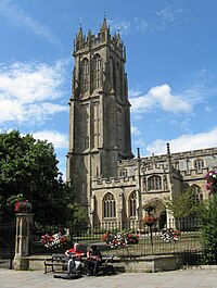
Churches in Glastonbury include:
- Church of England:
- St Benedict
- St John the Baptist
- Abbey House – retreat centre
- Independent evangelical: Mid Somerset Community Church
- Methodist: Glastonbury Methodist Church
- United Reformed Church: Glastonbury United Reformed Church
- Roman Catholic: St Mary's R C Church
The Church of St Benedict was rebuilt by Abbot Richard Beere in about 1520.[25]
The Church of St John the Baptist dates from the 15th century and has been designated as a Grade I listed building.[26] The church is laid out in a cruciform plan with an aisled nave and a clerestorey of seven bays. The west tower has elaborate buttressing, panelling and battlements. The interior of the church includes four 15th-century tomb-chests, some 15th-century stained glass in the chancel, mediæval vestments, and a domestic cupboard of about 1500 which was once at Witham Charterhouse.[27]
The United Reformed Church on the High Street was built in 1814 and altered in 1898. It stands on the site of the Ship Inn where meetings were held during the 18th century. It is Grade II listed.[28]
Glastonbury Abbey
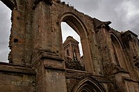
The remains of Glastonbury Abbey lie in the middle of town; once the dominant presence in the area, it is now a ruin and tourist attraction. Unlike some other dissolved abbeys in towns, its chapel was not preserved as a town church. The remains of the Abbot's Kitchen (a Grade I listed building.[29]) and the Lady Chapel are particularly well-preserved set in 36 acres of parkland. It is approached by the Abbey Gatehouse which was built in the mid-14th century and completely restored in 1810.[30]
Myths and legends
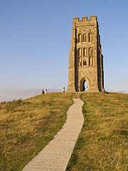
Such myths and legends swirl around Glastonbury, which often relate to Glastonbury Tor and King Arthur, legends which began out of the oddities of the Middle Ages and which have fed on each other and grown ever since.
When the idea of the Holy Grail appeared in mediæval French literature, it was soon appropriated to the legends of Joseph of Arimathea and that of King Arthur. King Arthur himself was said to be buried near the Abbey and this has blossomed into endless tails of the Holy Grail. In some Arthurian literature Glastonbury is identified with the legendary island of Avalon.
Glastonbury is also claimed to be the centre of several ley lines, an invented New Age concept naturally incapable of proof or disproof.
Joseph of Arimathea
Glastonbury Abbey was founded by King Ine, making it one of the earliest in the land, but in the Middle Ages the monks here claimed it was the oldest in the world, founded immediately after the Crucifixion by Joseph of Arimathea no less (he who donated his tomb to Jesus), and on that claim they attracted many generous pilgrims. They said that Joseph that Joseph brought holy relics and planbted them here, and that he stuck his staff into the ground, which flowered miraculously into the Glastonbury Thorn.
The legend was in time enhanced: the French poet Robert de Boron in the 13th-century wrote a romance in which Joseph of Arimathea bore to Britain the cup used at the Last Supper: the ultimate religious relic, which was all good for attracting pilgrims. Stories were pitched further into blasphemy with a claim that as a child, Jesus himself visited Glastonbury along with Joseph, and the pilgrims continued to come with their full purses. William Blake mentioned the legend in a poem that became a popular hymn, "Jerusalem" (see And did those feet in ancient time).[31]
Today Glastonbury Abbey presents itself, presumably with tongue in cheek, as "traditionally the oldest above-ground Christian church in the world," which according to the legend was built at Joseph's behest to house the Holy Grail, 65 or so years after the death of Jesus.[32]
The Glastonbury Thorn
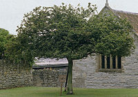
The legend of Joseph of Arimathea has him planting his staff into the ground, which it flowered miraculously into the Glastonbury Thorn (or Holy Thorn). This is said to explain a hybrid Crataegus monogyna (hawthorn) tree that only grows within a few miles of Glastonbury, and which flowers twice annually, once in spring and again around Christmas time (depending on the weather). Each year a sprig of thorn is cut, by the local Anglican vicar and the eldest child from St John's School, and sent to the Queen.[33]
The original Holy Thorn was a centre of pilgrimage in the Middle Ages but was chopped down during the English Civil War.[34] A replacement thorn was planted in the 20th century on Wearyall hill (originally in 1951 to mark the Festival of Britain; but the thorn had to be replanted the following year as the first attempt did not take).[35] It died in 1991 and a new one was planted. Each thorn is hailed as the original one in guidebooks.
In the later twentieth century, the thorn became bestrewn with ribbons placed there by neo-pagans. This thorn in turn was broken down by unknown hands in 2011.
Many other examples of the thorn grow throughout Glastonbury including those in the grounds of Glastonbury Abbey, St Johns Church and Chalice Well.
King Arthur
In 1191, monks at the abbey claimed to have found the graves of Arthur and Guinevere to the south of the Lady Chapel of the Abbey Church, which was visited by a number of contemporary historians including Gerald of Wales.[36] The remains were later moved and were lost during the Reformation. Many scholars suspect that this discovery was a pious forgery to substantiate the antiquity of Glastonbury's foundation, and increase its renown,[37] or a wheeze by Henry II to disrupt a Breton revolt, raised in the name of King Arthur and led by Henry's second son, Prince Arthur.
In some Arthurian literature Glastonbury is identified with the legendary island of Avalon. An early Welsh poem links Arthur to the Tor in an account of a confrontation between Arthur and Melwas, who had kidnapped Queen Guinevere.[38] According to some versions of the Arthurian legend, Lancelot retreated to Glastonbury Abbey in penance following Arthur's death.[39]
The Holy Grail
The idea of a "grail" was invented in a semi-religious romance, Perceval, le Conte du Graal, by Chrétien de Troyes in the twelfth century, though this graal is not explained. In later years it became conflated with the cup used at the Last Supper of which Robert de Boron had written a tale, and thus it was heaped in with the myths of Glastonbury Abbey.
As Perceval was aknight of King Arthur, the "Holy Grail" found its way into Arthurian legend and later stories have the knights roaming far and wide in search of the "Holy Grail", while at Glastonbury they claimed it was buried in a well at the foot of the Tor. Thus the mediæval stories converge on Glastonbury and in all the New Age shops and stalls found in the town.
Glastonbury zodiac
In 1934 artist Katherine Maltwood suggested a landscape zodiac, a map of the stars on a gigantic scale, formed by features in the landscape such as roads, streams and field boundaries, could be found situated around Glastonbury.[40] She held that the "temple" was created by Sumerians about 2700 BC. The idea of a prehistoric landscape zodiac was eagerly seized upon by the fashionable neo-pagans of the age and has appeared in endless books since then, still promoted by the New Age community around the town.
In 1975 Ian Burrow, a local archaeologist, was bestirred to examine the claims[41] and concluded that "while the outlines of the effigies may be plotted today, their antiquity is illusory". In 1983 Tom Williamson and Liz Bellamy did so[42] and disproved Maltwood's ideas. The eye of "Capricorn" identified by Maltwood was a haystack. The western wing of the "Aquarius" was a road laid in 1782 to run around Glastonbury, and older maps dating back to the 1620s show the road had no predecessors. "Cancer", plotted as a boat not a crab, was a network of 18th-century drainage ditches and paths. Of the genuine Neolithic paths preserved in the peat of the bog formerly comprising most of the area, none matches the lines of the "zodiac" features.
Geography
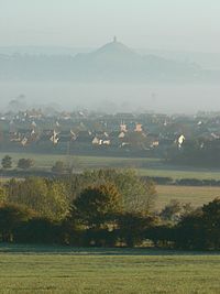
The walk up Glastonbury Tor to the ruined church at the summit is rewarded by a far view across the Levels and the heart of Somerset. From there it is easy to appreciate how Glastonbury was once an island and, in the winter, the surrounding moors are often flooded, giving that appearance once more.
It is an agricultural region typically with open fields of permanent grass, surrounded by ditches with willow trees. Access to the moors and Levels is by "droves". The Levels and inland moors can be 20 feet below peak tides and have large areas of peat. The low-lying areas are underlain by much older Triassic age formations of Upper Lias sand that protrude to form what would once have been islands and include Glastonbury Tor.[43][44] The lowland landscape was formed only during the last 10,000 years, following the end of the last ice age.[45]
The low lying damp ground can produce a visual effect known as a Fata Morgana. This optical phenomenon occurs because rays of light are strongly bent when they pass through air layers of different temperatures in a steep thermal inversion where an atmospheric duct has formed.[46] The Italian name Fata Morgana is derived from the name of Morgan le Fay, who was alternatively known as Morgane, Morgain, Morgana and other variants. Morgan le Fay was described as a powerful sorceress and antagonist of King Arthur and Queen Guinevere in the Arthurian legend.
Glastonbury is less than a mile across the River Brue from the village of Street.
Until the Levels were drained, the Brue formed a lake just south of the hilly ground on which Glastonbury stands. This lake is one of the locations suggested by Arthurian legend as the home of the Lady of the Lake. Pomparles Bridge stood at the western end of this lake, guarding Glastonbury from the south, and some versions of the legend suggest that it was here that Sir Bedivere threw Excalibur into the waters after King Arthur fell at the Battle of Camlann.[47] The old bridge was replaced by a reinforced concrete arch bridge in 1911.[48]
Until the 13th century, the direct route to the sea at Highbridge was prevented by gravel banks and peat near Westhay.[49] The course of the river partially encircled Glastonbury from the south, around the western side (through Beckery), and then north through the Panborough-Bleadney gap in the Wedmore-Wookey Hills, to join the River Axe just north of Bleadney. This route made it difficult for the officials of Glastonbury Abbey to transport produce from their outlying estates to the abbey, and when the valley of the River Axe was in flood it backed up to flood Glastonbury itself. Some time between 1230 and 1250 a new channel was constructed westwards into Meare Pool north of Meare, and further westwards to Mark Moor. The Brue Valley Living Landscape is a conservation project based on the Somerset Levels and Moors and managed by the Somerset Wildlife Trust.[50] The project commenced in January 2009 and aims to restore, recreate and reconnect habitat, ensuring that wildlife is enhanced and capable of sustaining itself in the face of climate change, while guaranteeing farmers and other landowners can continue to use their land profitably.[50] It is one of an increasing number of landscape scale conservation projects in the United Kingdom.[51][52]
The Whitelake River rises between two low limestone ridges to the north of Glastonbury, part of the southern edge of the Mendip Hills. The joining of the two small brooks that make the Whitelake River is on Worthy Farm, the site of the Glastonbury Festival, between the small villages of Pilton and Pylle.
Sights about the town
 Glastonbury Abbey ruins
 The Tribunal: a mediæval merchant's house, used as the Abbey courthouse and during the "Bloody Assizes" by Judge Jeffreys.[53] It now serves as a museum run by the Glastonbury Antiquarian Society.[54]
- Market Cross, an octagonal market cross built in 1846 by Benjamin Ferrey.[55]
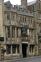
- The George Hotel and Pilgrims' Inn, built in the late 15th century to accommodate visitors to Glastonbury Abbey: a Grade I listed building.[56] The front of the 3-storey building is divided into 3 tiers of panels with traceried heads. Above these are 3 carved panels with arms of the Abbey and Edward IV.
 The Somerset Rural Life Museum: a museum of the social and agricultural history of Somerset, housed in buildings surrounding a 14th-century barn once belonging to Glastonbury Abbey, a Grade I listed building.
- The Chalice Well: a well at the foot of the Tor which has been the subject of some of the local legends, Christian and pagan. It is covered by a wooden well-cover with wrought-iron decoration made in 1919. Water issues from the spring at a rate of 25,000 gallons a day and has never failed, even during drought. The well is about 9 feet deep, with two underground chambers at its bottom.[57]
Culture
Glastonbury has been described as a New Age community as a result of the large number of neo-pagans and New Agers settled here.[58][59]
The town and its various Arthurian legends have found there way into many books or inspired them, amongst a few of which are:
- A Prince of Cornwall by Charles Whistler (1904) treats of Glastonbury in the days of Ine of Wessex
- The Warlord Chronicles by Bernard Cornwell is a trilogy of books about Arthurian Britain, in which Glastonbury often features.
- The Age of Misrule books by Mark Chadbourn features a group selected from Anglican priests in and around Glastonbury to safeguard knowledge of a gate to the Otherworld on top of Glastonbury Tor.
These are at least the more level-headed of novels involving the town.
Festivals
The first Glastonbury Festivals were held each summer, from 1914 to 1926, founded by British composer Rutland Boughton and his librettist Lawrence Buckley.[60] Apart from the founding of a national theatre, they envisaged a summer school and music festival based on utopian principles.[61] With strong King Arthur|Arthurian connections and historic and prehistoric associations, Glastonbury was chosen to host the festivals.
The more recent Glastonbury Festival ("the Glastonbury Festival of Performing Arts") was founded in 1970, is now the largest open-air music and performing arts festival. Though named for Glastonbury, it is held at Worthy Farm between the small villages of Pilton and Pylle, 6 miles east of the town.[62] The festival is best known for its contemporary music, but also features dance, comedy, theatre, circus, cabaret and many other arts. The festival has spawned a range of other work including the 1972 film Glastonbury Fayre[63] and album, 1996 film Glastonbury the Movie[64] and the 2005 DVD Glastonbury Anthems.[65]
Glastonbury is one of the venues for the annual West Country Carnival.[66]
Outside links
| ("Wikimedia Commons" has material about Glastonbury) |
References
- ↑ "Morlands demolition progressing well". South West RDA. 7 August 2003. http://www.southwestrda.org.uk/news/release.asp?ReleaseID=882. Retrieved 8 April 2009.
- ↑ "Old tannery demolition continues". BBC. 9 January 2004. http://news.bbc.co.uk/1/hi/england/somerset/3383521.stm. Retrieved 8 April 2009.
- ↑ "West Mendip Opportunities". Somerset Rural Regeneration. http://www.somerset-rural-renaissance.co.uk/projects-west-mendip-opportunities.html. Retrieved 14 May 2010.
- ↑ 4.0 4.1 Gray, Louis H. (1935). Speculum, Vol. 10, No. 1: The Origin of the Name of Glastonbury p46-53. Mediæval Academy of America.
- ↑ Anon (12 August 2009). "London's earliest timber structure found during Belmarsh prison dig". physorg.com News. PhysOrg.com. http://www.physorg.com/news169297178.html. Retrieved 10 July 2010.
- ↑ "The day the Sweet Track was built". New Scientist, 16 June 1990. http://www.newscientist.com/article/mg12617212.800.html. Retrieved 26 October 2007.
- ↑ "Special issue on Wetlands / The Somerset Levels". Current Archaeology 172. Current Archaeology. 5 April 2007. Archived from the original on 5 April 2007. http://web.archive.org/web/20070405210503/http://archaeology.co.uk/ca/issues/ca172/ca172.htm. Retrieved 26 October 2007.
- ↑ Williams, Robin; Williams, Romey (1992). The Somerset Levels. Bradford on Avon: Ex Libris Press. pp. 35–36. ISBN 0948578386.
- ↑ Hill-Cottingham, Pat; Briggs, D., Brunning, R., King, A. & Rix, G (2006). The Somerset Wetlands. Somerset Books. ISBN 0-86183-432-1.
- ↑ Anglo-Saxon Chronicle (688 Chronicle) (Parker) Her Ine feng to Wesseaxna rice, and heold .xxxvii. wintra and he getimbrade þæt menster æt Glæstingabyrig
- ↑ "Edmund II Ironside". English Monarchs. http://www.englishmonarchs.co.uk/saxon_15.htm. Retrieved 5 July 2010.
- ↑ "St Margaret's Chapel". St Margaret's Chapel. http://www.stmargaretschapel.org/home.html. Retrieved 5 July 2010.
- ↑ "Almshouses and Chapel of St Mary Magdalene's Hospital". Images of England. English Heritage. http://www.imagesofengland.org.uk/Details/Default.aspx?id=265986. Retrieved 5 July 2010.
- ↑ "Glastonbury Abbey". Cathedrals Plus. The Pilgrims Association. http://www.cathedralsplus.org.uk/index.php/front_end/member/47/about.html. Retrieved 19 August 2008.
- ↑ "Lady Catherine Gordon (d. 1537)". Royal Berkshire History. Nash Ford Publishing. http://www.berkshirehistory.com/bios/cgordon.html. Retrieved 22 August 2010.
- ↑ "Glastonbury Monks". Glastonbury Shrine. http://www.glastonburyshrine.co.uk/monks.htm. Retrieved 4 July 2010.
- ↑ "Abbots Sharpham and Sharpham Park Farmhouse". Images of England. http://www.imagesofengland.org.uk/details/default.aspx?id=267774. Retrieved 25 November 2006.
- ↑ "The Town". The Historical Society of Glastonbury. http://town.glasct.org/hissoc/Glastonbury/town.html. Retrieved 6 September 2010.
- ↑ 19.0 19.1 19.2 G. Body and R. Gallop, (2001), The Glastonbury Canal, Fiducia Press, ISBN 0-946217-08-4
- ↑ Somerset Waterways Development Trust
- ↑ Handley, Chris, (2001). The Maritime Activities of the Somerset & Dorset Railway. Bath: Millstream Books. ISBN 0-948975-63-6.
- ↑ Scott, Shane (1995). The hidden places of Somerset. Aldermaston: Travel Publishing Ltd. p. 82. ISBN 1902007018.
- ↑ "History". Street Society. http://www.streetsociety.org/chairmans_history.php. Retrieved 21 August 2009.
- ↑ Bush, Robin (1994). Somerset: The complete guide. Dovecote Press. pp. 104–108. ISBN 1874336261.
- ↑ National Heritage List 1057966: Church of St Benedict
- ↑ "Church of St John the Baptist, High Street (North side), Glastonbury". Somerset Historic Environment Record. Somerset County Council. http://webapp1.somerset.gov.uk/her/details.asp?prn=20585. Retrieved 18 May 2009.
- ↑ National Heritage List 1345459: Church of St John the Baptist
- ↑ National Heritage List 1057939: Congregational Church
- ↑ "Abbot's Kitchen, Glastonbury Abbey". Images of England. http://www.imagesofengland.org.uk/details/default.aspx?id=265971. Retrieved 11 November 2006.
- ↑ National Heritage List 1345446: Glastonbury
- ↑ "Jerusalem". Icons.org. http://www.icons.org.uk/theicons/collection/jerusalem/features/and-did-those-feet. Retrieved 5 July 2010.
- ↑ "Joseph of Arimathea". Glastonbury Abbey. http://www.glastonburyabbey.com/arimathea.php?&rpn=myths. Retrieved 22 August 2010.
- ↑ Wheeler, David (12 January 2002). "Branch lines: the Glastonbury thorn". The Telegraph (London). http://www.telegraph.co.uk/gardening/3296455/Branch-lines-the-Glastonbury-thorn.html. Retrieved 5 July 2010.
- ↑ Stout, Adam. "The Thorn and The Waters Miraculous Glastonbury In the Eighteenth Century" (PDF). p. 6. http://glastonburyantiquarians.org/site/files/1211915309-The%20Thorn%20and%20the%20Waters%20%20PDF.pdf. Retrieved 22 August 2010.
- ↑ Bowman, Marion (August 2006). "The Holy Thorn Ceremony: Revival, Rivalry and Civil Religion in Glastonbury". Folklore 117 (2): 117 123–140. doi:10.1080/00155870600707805. http://www.ingentaconnect.com/content/routledg/rfol/2006/00000117/00000002/art00001?crawler=true. Retrieved 19 August 2008.
- ↑ "King Arthur & Avalon". Glastonbury Abbey. http://www.glastonburyabbey.com/arthur.php. Retrieved 5 July 2010.
- ↑ Carley, James P. (1996). "8 Arthur, Avalon and the Bridge Perilous". Glastonbury Abbey The Holy House at the Head of the Moors Adventurous. Gothic Image Publications. ISBN 978-0906362235. http://www.gothicimage.co.uk/books/glastabbey8.html. Retrieved 25 August 2010.
- ↑ "Queen Guinevere". Arthurian Legend. http://www.arthurian-legend.com/more-about/more-about-arthur-9.php. Retrieved 5 July 2010.
- ↑ "Glastonbury". Crystal Links. http://www.crystalinks.com/glastonburytor.html. Retrieved 22 August 2010.
- ↑ Maltwood, K. E. A Guide to Glastonbury's Temple of the Stars: Their Giant Effigies Described From Air Views, Maps, and From "The High History of the Holy Grail" (London, The Women's Printing Society, Ltd., 1934). Her next book on the subject matter, Air View Supplement To A Guide To Glastonbury's Temple of The Stars was published in 1937.
- ↑ Ian Burrow, Somerset's Planning Department staff archeologist
- ↑ Tom Williamson, Liz Bellamy, Ley Lines In Question, pages 162-168. (Tadworth, UK: World's Work, 1983). ISBN 0437192059
- ↑ "Somerset". Natural England. http://www.english-nature.org.uk/special/geological/sites/area_ID30.asp. Retrieved 10 June 2007.
- ↑ "Somerset Levels and Moors Natural Area – A nature conservation profile July 1997" (PDF). English Nature. http://www.english-nature.org.uk/science/natural/profiles/naProfile85.pdf. Retrieved 10 June 2007.
- ↑ Hardy, Peter (1999). The Geology of Somerset. Bradford on Avon: Ex Libris Press. pp. 185–186. ISBN 0948578424.
- ↑ Young, Andrew. "An Introduction to Mirages". San Diego State University. http://mintaka.sdsu.edu/GF/mirages/mirintro.html. Retrieved 5 July 2010.
- ↑ "Pomparles Bridge". ArthurianAdventure.com. http://www.arthurianadventure.com/pomparles_bridge.htm. Retrieved 11 November 2008.
- ↑ "Pomparles Bridge, Northover, Glastonbury". Somerset Historic Environment Record. Somerset County Council. http://webapp1.somerset.gov.uk/her/details.asp?prn=23577. Retrieved 4 July 2010.
- ↑ "Meare and Ferran Mere". Sacred Sites around Glastonbury. http://www.isleofavalon.co.uk/sacredsites/meare.html. Retrieved 1 November 2008.
- ↑ 50.0 50.1 "Brue Valley Living Landscape". Somerset Wildlife Trust. http://www.somersetwildlife.org/brue_valley.html. Retrieved 2 July 2010.
- ↑ "a living landscape". Wildlife Trusts. http://www.wildlifetrusts.org/?section=environment:livinglandscapes. Retrieved 5 July 2010.
- ↑ "RSPB landscape conservation". Royal Society for the Protection of Birds. http://www.rspb.org.uk/ourwork/farming/policy/landuse/landscape.asp. Retrieved 5 July 2010.
- ↑ National Heritage List 1345457: The Tribunal (Grade I listing)
- ↑ "Glastonbury Antiquarian Society". Glastonbury Antiquarian Society. http://www.glastonburyantiquarians.org/site/index.php. Retrieved 22 May 2009.
- ↑ National Heritage List 1057910: Market Cross
- ↑ National Heritage List 1345455: George Hotel and Pilgrims' Inn
- ↑ National Heritage List 1167594: The Chalice Well (Grade I listing)
- ↑ Craig, David. "Capital of the New Age". Strum. http://www.strum.co.uk/twilight/glas0.htm. Retrieved 6 September 2010.
- ↑ Lambert, Tim. "A brief hostory of Glastonbury, Somerset". Tim Lambert. http://www.localhistories.org/glastonbury.html. Retrieved 6 September 2010.
- ↑ "Profile". The Rutland Boughton Music Trust.. http://www.rutlandboughtonmusictrust.org.uk/cgi-bin/newslist.cgi?area=news&storycode=../public_html/news/maint/data/profile.txt. Retrieved 6 July 2010.
- ↑ "Glastonbury the First Time". Utopia Britannica. http://www.utopia-britannica.org.uk/pages/Glastonbury.htm. Retrieved 6 July 2010.
- ↑ "An introduction to Glastonbury Festival". Glastonbury Festival. http://www.glastonburyfestivals.co.uk/information/what-is-glastonbury/. Retrieved 6 July 2010.
- ↑ "Glastonbury Fayre". IMDB. http://www.imdb.com/title/tt0810001/. Retrieved 6 July 2010.
- ↑ "Glastonbury the movie". Glastonbury the movie. http://www.glastonburythemovie.com/. Retrieved 6 July 2010.
- ↑ "Glastonbury Anthems". Glastonbury Anthems. http://www.glastonburyanthems.com/. Retrieved 6 July 2010.
- ↑ "Somerset Carnivals". Somerset Carnivals. http://www.somersetcarnivals.co.uk/. Retrieved 8 July 2010.
