River Irfon: Difference between revisions
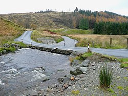
Created page with "File:Afon Irfon, below the Devil's Staircase, Powys - geograph.org.uk - 1071151.jpg|250px|right|thumb|The drovers road to Tregaron crosses the Irfon via the Irish bridge at ..." |
|||
| Line 17: | Line 17: | ||
==References== | ==References== | ||
*Location map: {{wmap|52.237|-3.715}} | |||
{{reflist}} | {{reflist}} | ||
{{commons category}} | {{commons category}} | ||
{{stub}} | {{stub}} | ||
[[Category:Rivers of Brecknockshire]] | [[Category:Rivers of Brecknockshire|Irfon]] | ||
Latest revision as of 22:54, 1 March 2016


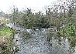
The River Irfon is a river in Brecknockshire. It flows from the upper slopes of Bryn Garw in the Cambrian Mountains, through the Abergwesyn Valley, past the Nant Irfon National Nature Reserve in the hills above the village of Abergwesyn, and through Llanwrtyd Wells to its confluence with the River Wye at Builth Wells. The source of the Irfon is in the so-called Desert of Wales.
Description

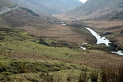
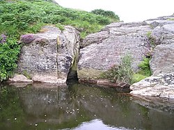
From its source at 1,770 feet above sea level on the upper slopes of Bryn Garw in the Cambrian Mountains the Irfon flows southwards past the foot of the Devil's Staircase, along the Abergwesyn Valley, through the scenic Wolves' Gorge, and into the Wolves Pool. It then flows past the forest of Sessile Oaks (Quercus petraea) to join the River Gwesyn at Abergwesyn where it passes beneath the Irfon Forest and the Nant Irfon National Nature Reserve towards Llanwrtyd Wells. Then it flows eastward through Llangammarch Wells, and Garth to join the River Wye at Builth Wells. An overall length of approximately 28 miles.[1]
The Irfon defines the northern limit of the Mynydd Epynt area between Llanwrtyd Wells and Builth Wells.
History

The river is famous in Welsh history for the fact that it was on its banks, in the vicinity of Cilmery, that Llywelyn ap Gruffudd Prince of Wales, was killed on 11 December 1282.
Literature
The Abergwesyn Valley and the legend of the boy failing to safely leap the Wolves' Gorge were described by George Borrow in his 1862 travel publication Wild Wales: Its People, Language and Scenery.
References
- Location map: 52°14’13"N, 3°42’54"W
| ("Wikimedia Commons" has material about Irfon River Irfon) |
This article is a stub: help to improve Wikishire by building it up.
