Lindean: Difference between revisions
Jump to navigation
Jump to search
No edit summary |
No edit summary |
||
| Line 2: | Line 2: | ||
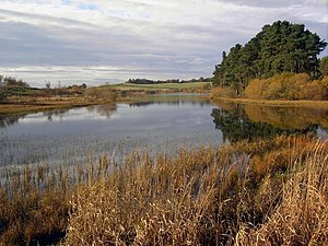
[[File:Lindean Reservoir - geograph.org.uk - 1583786.jpg|thumb|Lindean Reservoir]] | [[File:Lindean Reservoir - geograph.org.uk - 1583786.jpg|thumb|Lindean Reservoir]] | ||
'''Lindean''' is a village in north-western [[Roxburghshire]], close to the border with [[Selkirkshire]]. It lies north-east of [[Selkirk]] and east of the [[Ettrick Water]], which here forms the county border. | '''Lindean''' is a village in north-western [[Roxburghshire]], close to the border with [[Selkirkshire]]. It lies north-east of [[Selkirk]] and east of the [[Ettrick Water]], which here forms the county border. | ||
The ancient parish of Lindean is now united to that of [[Galashiels]]. Its church, disused since 1586, stood north of Bridgelands Road just off the A7 and was the place where the body of William Douglas, the Knight of Liddesdale, lay during the night after his assassination in 1353. | |||
==Outside links== | ==Outside links== | ||
Latest revision as of 11:12, 14 December 2015

Lindean is a village in north-western Roxburghshire, close to the border with Selkirkshire. It lies north-east of Selkirk and east of the Ettrick Water, which here forms the county border.
The ancient parish of Lindean is now united to that of Galashiels. Its church, disused since 1586, stood north of Bridgelands Road just off the A7 and was the place where the body of William Douglas, the Knight of Liddesdale, lay during the night after his assassination in 1353.
Outside links
| ("Wikimedia Commons" has material about Lindean) |
- Location map: 55°34’0"N, 2°48’-0"W
- CANMORE/RCAHMS record of Lindean
- Scottish Borders Council: Lindean Loch
- Geograph image: Lindean Reservoir
- Geograph image: Lindean Farm
- Lindean Community Woodland
This Roxburghshire article is a stub: help to improve Wikishire by building it up.
