File:Stanley - Port, airport and Yorke Bay.svg
From Wikishire

Size of this preview: 800 × 589 pixels. Other resolution: 320 × 236 pixels.
Original file (SVG file, nominally 1,636 × 1,204 pixels, file size: 3.34 MB)
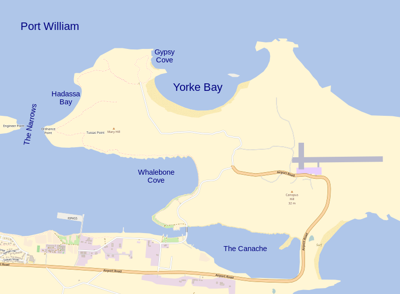
| Description | Map of the cruise ship port, the airport and Yorke Bay by Stanley, East Falkland | |||||||||||||||
| Date | ||||||||||||||||
| Source | Stanley and Stanley Harbour.svg | |||||||||||||||
| Author | Hogweard | |||||||||||||||
| Permission (Reusing this file) |
|
File history
Click on a date/time to view the file as it appeared at that time.
| Date/Time | Thumbnail | Dimensions | User | Comment | |
|---|---|---|---|---|---|
| current | 20:19, 11 May 2017 | | 1,636 × 1,204 (3.34 MB) | Hogweard | {{Information |Description=Map of the cruise ship port, the airport and Yorke Bay by Stanley, East Falkland |Source={{f|Stanley and Stanley Harbour.svg}} |Date=2017-05-11 |Author={{u|Hogweard}} |Permission={{OpenStreetMap|name=Stanley, Falkland Islands... |
File usage
The following file is a duplicate of this file (more details):
- File:Stanley - Port, airport and Yorke Bay.svg from a shared repository
There are no pages that link to this file.