File:Map of River irwell.png
From Wikishire

Size of this preview: 337 × 599 pixels. Other resolution: 135 × 240 pixels.
Original file (1,444 × 2,567 pixels, file size: 305 KB, MIME type: image/png)
Summary
| Description |
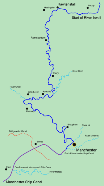
English: A map of the River Irwell |
| Date | |
| Source | Own work |
| Author | Parrot of Doom |
Licensing
| I, the copyright holder of this work, release this work into the public domain. This applies worldwide. In some countries this may not be legally possible; if so: I grant anyone the right to use this work for any purpose, without any conditions, unless such conditions are required by law. |
File history
Click on a date/time to view the file as it appeared at that time.
| Date/Time | Thumbnail | Dimensions | User | Comment | |
|---|---|---|---|---|---|
| current | 19:15, 24 October 2008 | | 1,444 × 2,567 (305 KB) | Parrot of Doom | {{Information |Description=Added Manchester Ship Canal |Source= |Date= |Author= |Permission= |other_versions= }} |
File usage
The following file is a duplicate of this file (more details):
- File:Map of River irwell.png from a shared repository
The following 2 pages link to this file: