File:Gryme's Dyke - geograph.org.uk - 142663.jpg
From Wikishire

Size of this preview: 450 × 600 pixels. Other resolution: 180 × 240 pixels.
Original file (480 × 640 pixels, file size: 124 KB, MIME type: image/jpeg)
Summary
| Description |
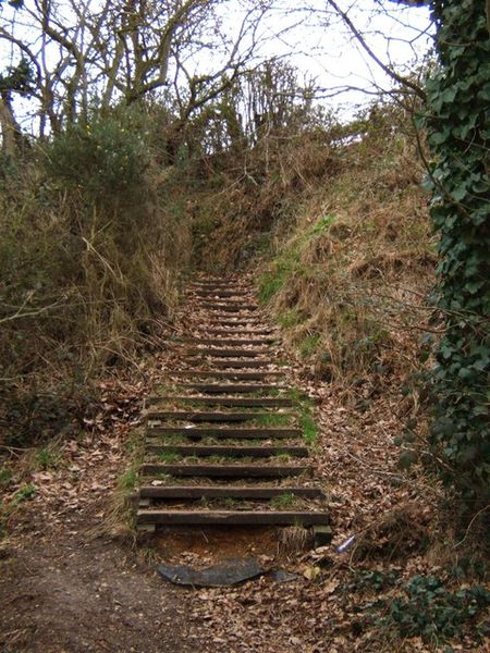
English: Gryme's Dyke. These steps climb up Gryme's Dyke part of the Iron Age Lexden Earthworks. Gryme's Dyke survives over a three-mile long stretch. The earthworks defended Camvlodvnvm; they were taken over and improved by the Romans. You can see another part of the network of defences at 142655 |
| Date | |
| Source | From geograph.org.uk |
| Author | Glyn Baker |
| Attribution (required by the license) | Glyn Baker / Gryme's Dyke / |
| Camera location | | View this and other nearby images on: OpenStreetMap |
|---|
_&language=en)
| Object location | | View this and other nearby images on: OpenStreetMap |
|---|
_&language=en)
Licensing

|
This image was taken from the Geograph project collection. See this photograph's page on the Geograph website for the photographer's contact details. The copyright on this image is owned by Glyn Baker and is licensed for reuse under the Creative Commons Attribution-ShareAlike 2.0 license.
|
This file is licensed under the Creative Commons Attribution-Share Alike 2.0 Generic license.
Attribution: Glyn Baker
- You are free:
- to share – to copy, distribute and transmit the work
- to remix – to adapt the work
- Under the following conditions:
- attribution – You must give appropriate credit, provide a link to the license, and indicate if changes were made. You may do so in any reasonable manner, but not in any way that suggests the licensor endorses you or your use.
- share alike – If you remix, transform, or build upon the material, you must distribute your contributions under the same or compatible license as the original.
File history
Click on a date/time to view the file as it appeared at that time.
| Date/Time | Thumbnail | Dimensions | User | Comment | |
|---|---|---|---|---|---|
| current | 07:09, 31 January 2010 | | 480 × 640 (124 KB) | GeographBot | == {{int:filedesc}} == {{Information |description={{en|1=Gryme's Dyke. These steps climb up Gryme's Dyke part of the Iron Age Lexden Earthworks. Gryme's Dyke survives over a three-mile long stretch. The earthworks defended Camvlodvnvm; they were taken ove |
File usage
The following file is a duplicate of this file (more details):
- File:Gryme's Dyke - geograph.org.uk - 142663.jpg from a shared repository
The following 2 pages link to this file: