File:FalklandEconomicZone.png
From Wikishire
Size of this preview: 799 × 600 pixels. Other resolution: 320 × 240 pixels.
Original file (938 × 704 pixels, file size: 807 KB, MIME type: image/png)
Summary
| Description |
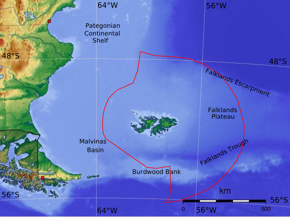
English: Map of the Falkland Islands maritime economic zone |
| Date | |
| Source | Own work |
| Author | Martinvl |
This work used [Argentine_Topo_blank.jpg] as a start point.
Licensing
I, the copyright holder of this work, hereby publish it under the following license:
This file is licensed under the Creative Commons Attribution 3.0 Unported license.
- You are free:
- to share – to copy, distribute and transmit the work
- to remix – to adapt the work
- Under the following conditions:
- attribution – You must give appropriate credit, provide a link to the license, and indicate if changes were made. You may do so in any reasonable manner, but not in any way that suggests the licensor endorses you or your use.
File history
Click on a date/time to view the file as it appeared at that time.
| Date/Time | Thumbnail | Dimensions | User | Comment | |
|---|---|---|---|---|---|
| current | 12:12, 2 April 2016 | | 938 × 704 (807 KB) | Martinvl | "Burnwood" => "Burdwood" (correct file this time I hope!) |
File usage
The following file is a duplicate of this file (more details):
- File:FalklandEconomicZone.png from a shared repository
The following page links to this file: