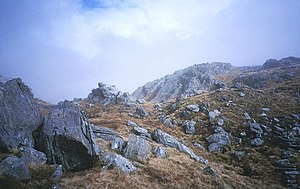
Sgùrr an Utha
| Sgùrr an Utha | |
 West ridge of Sgùrr an Utha, just below the summit | |
|---|---|
| Summit: | 2,612 feet NM885839 56°53’54"N, 5°28’28"W |
Sgùrr an Utha is a hills above Glenfinnan, in Inverness-shire, joined to neighbouring Fraoch-bheinn by a summit ridge at 0 feet above sea level at its lowest elevation. Glen Finnan itself lies just to the east. Reaching 2,612 feet in height, Sgùrr an Utha is listed as a ‘Corbett’. Neighbouring Fraoch-bheinn, just a thousand yards to the east, may be considered a subsidiary top.
The name ‘’Sgùrr an Utha’’ is Gaelic, and means “Peak of the Udder”.
These hills have the only known site in the British Isles for the arctic plant Diapensia lapponica, first discovered here in 1951.
Ascent
Sgùrr an Utha and Fraoch-bheinn are most commonly climbed together from Glen Finnan to the south. One possible route initially follows a track at the bottom of the river Allt an Utha which leaves the A830 road about 1.5 miles west of Glenfinnan station to first ascend Sgùrr an Utha. A circular route may be made by continuing south from the summit of Fraoch-bheinn, eventually picking up the track on the slopes of Druim na Brein Choille, Fraoch-bheinn's southern ridge.
Alternative routes include a direct ascent of Fraoch-bheinn from Glenfinnan station, or by climbing to the low point between the two summits from the Caol-ghleann, the valley to the north side of the hill. Caol-ghlean curves round to meet Glen Finnan near the station, thus a circular route can be made by walkers using rail to access the area.