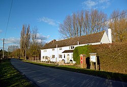
Kingston Stert
From Wikishire
Revision as of 20:58, 20 February 2023 by RB (Talk | contribs) (Created page with "{{Infobox town |name=Kingston Stert |county=Oxfordshire |picture=Rose Cottage, Kingston Stert - geograph.org.uk - 3321503.jpg |picture caption=Rose Cottage, Kingston Stert |os...")
| Kingston Stert | |
| Oxfordshire | |
|---|---|
 Rose Cottage, Kingston Stert | |
| Location | |
| Grid reference: | SP726011 |
| Location: | 51°42’17"N, 0°57’0"W |
| Data | |
| Postcode: | OX39 |
| Local Government | |
| Council: | South Oxfordshire |
| Parliamentary constituency: |
Henley |
Kingston Stert is a tiny hamlet in eastern Oxfordshire, just up a track to the north of Kingston Blount and sitting just south-west of Sydenham.
This Oxfordshire article is a stub: help to improve Wikishire by building it up.