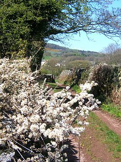
Arnaby
From Wikishire
Revision as of 21:09, 14 June 2017 by RB (Talk | contribs) (Created page with "{{Infobox town |name=Arnaby |county=Cumberland |picture=Track near Arnaby - geograph.org.uk - 541890.jpg |picture caption=Track near Arnaby |os grid ref=SD183847 |latitude=54....")
| Arnaby | |
| Cumberland | |
|---|---|
 Track near Arnaby | |
| Location | |
| Grid reference: | SD183847 |
| Location: | 54°15’6"N, 3°15’20"W |
| Data | |
| Post town: | Millom |
| Postcode: | LA18 |
| Dialling code: | 01229 |
| Local Government | |
| Council: | Cumberland |
| Parliamentary constituency: |
Copeland |
Arnaby is a hamlet near the southernmost part of Cumberland, on the coastal plain running down to the Duddon Sands. The town of Millom, at the county's southern tip. Is three miles to the south.
This Cumberland article is a stub: help to improve Wikishire by building it up.