Alicehead
From Wikishire
Revision as of 12:50, 4 May 2021 by RB (Talk | contribs) (Created page with "{{Infobox town |name=Alicehead |county=Derbyshire |picture=Alicehead_Road.jpg |picture caption=Alicehead Road. |os grid ref=SK334659 |latitude=53.19 |longitude=-1.501 |populat...")
| Alicehead | |
| Derbyshire | |
|---|---|
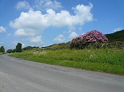
 Alicehead Road. | |
| Location | |
| Grid reference: | SK334659 |
| Location: | 53°11’24"N, 1°30’4"W |
| Data | |
| Post town: | Chesterfield |
| Postcode: | S45 |
| Local Government | |
| Council: | North East Derbyshire |
Alicehead is a hamlet in north-eastern Derbyshire, nine miles south-west of Chesterfield. It consists of four farms and a cottage on Alicehead Road, close to the junction of Darley Road and the A632.
The hamlet contains four and a half acres of upland heathland. The population was minimal at the 2011 Census and not separately recorded (details were included in the civil parish of Ashover).