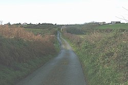
Engedi, Anglesey
From Wikishire
Revision as of 16:54, 21 May 2012 by RB (Talk | contribs) (Created page with '{{Infobox town |name=Engedi |county=Anglesey |picture=Country road approaching Penterfyn Cottage, with the village of Engedi in the background - geograph.org.uk - 1068503.jpg |os…')
| Engedi | |
| Anglesey | |
|---|---|

| |
| Location | |
| Grid reference: | SH362762 |
| Location: | 53°15’24"N, 4°27’12"W |
| Data | |
| Postcode: | LL65 |
| Local Government | |
| Council: | Anglesey |
| Parliamentary constituency: |
Ynys Môn |
Engedi is a village on the Isle of Anglesey.
Name
The name "En Gedi" is biblical, referring to Engedi, an oasis in the Holy Land.
In Joshua 15:62, Ein Gedi is enumerated among the cities of the Tribe of Judah in the desert Betharaba, but Ezekiel 47:10 shows that it was also a fisherman's town. Later, King David hides in the desert of En Gedi (1 Samuel 24:1-2) and King Saul seeks him "even upon the most craggy rocks, which are accessible only to wild goats" (1 Samuel 24:3).
The Song of Songs (Songs 1:14) speaks of the "vineyards of En Gedi".