Difference between revisions of "Beighton Fields"
From Wikishire
(Created page with "{{Infobox town |name=Beighton Fields |county=Derbyshire |picture=Beighton Fields.jpg |os grid ref=SK454768 |latitude=53.2867 |longitude=-1.3204 |population= |post town=Chester...") |
|||
| Line 13: | Line 13: | ||
|constituency=Chesterfield | |constituency=Chesterfield | ||
}} | }} | ||
| − | '''Beighton Fields''' is a scattered hamlet in [[Derbyshire]], just south-east of [[ | + | '''Beighton Fields''' is a scattered hamlet in [[Derbyshire]], just south-east of [[Renishaw]] and north of [[Staveley, Derbyshire|Staveley]]. |
==References== | ==References== | ||
Latest revision as of 18:16, 9 May 2021
| Beighton Fields | |
| Derbyshire | |
|---|---|

| |
| Location | |
| Grid reference: | SK454768 |
| Location: | 53°17’12"N, 1°19’13"W |
| Data | |
| Post town: | Chesterfield |
| Postcode: | S43 |
| Dialling code: | 01246 |
| Local Government | |
| Council: | Chesterfield |
| Parliamentary constituency: |
Chesterfield |
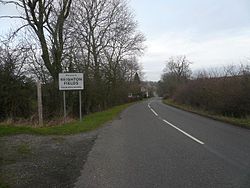
Beighton Fields is a scattered hamlet in Derbyshire, just south-east of Renishaw and north of Staveley.
References
Outside links
| ("Wikimedia Commons" has material about Beighton Fields) |