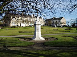
Carluke: Difference between revisions
Created page with '{{Infobox town |name=Carluke |county=Lanarkshire |picture=Carluke - geograph.org.uk - 122432.jpg |picture caption=Carluke |population=13,454 |census year=2001 |os grid ref=NS8485…' |
No edit summary |
||
| Line 33: | Line 33: | ||
**[http://www.kirktonchurch.org.uk/ Kirkton Church, Carluke] | **[http://www.kirktonchurch.org.uk/ Kirkton Church, Carluke] | ||
**[http://www.carluke-stjohns.org.uk/index.shtm St John's] | **[http://www.carluke-stjohns.org.uk/index.shtm St John's] | ||
*Baptist: [www.carluke-baptist.org.uk/ Carluke Baptist Church] | *Baptist: [http://www.carluke-baptist.org.uk/ Carluke Baptist Church] | ||
*United Reformed Church | *United Reformed Church | ||
*Roman Catholic: [http://www.stathanasius.co.uk/ St Athanasius Church, Carluke] | *Roman Catholic: [http://www.stathanasius.co.uk/ St Athanasius Church, Carluke] | ||
| Line 41: | Line 41: | ||
In a charter by Robert I, dated 1315, Carluke is written "Carneluk"; at different periods it appears as ''Carlowck'', ''Carlowk'', ''Carluk'', ''Carlook'', ''Carlouk'' and ''Carluke''. ''Car'' or ''Caer'' tells us that it is a height or strong position and Luke suggests that it may be dedicated to the saint of that name, however there is evidence that the earliest church was dedicated to St Andrew. | In a charter by Robert I, dated 1315, Carluke is written "Carneluk"; at different periods it appears as ''Carlowck'', ''Carlowk'', ''Carluk'', ''Carlook'', ''Carlouk'' and ''Carluke''. ''Car'' or ''Caer'' tells us that it is a height or strong position and Luke suggests that it may be dedicated to the saint of that name, however there is evidence that the earliest church was dedicated to St Andrew. | ||
The town was chartered as a Royal Burgh in 1662. | The town was chartered as a Royal Burgh in 1662. Carluke expanded during through the industrial age, with work involving corn milling, cotton weaving, coal mining and the manufacture of bricks, glass, confectionery and jam. | ||
==References== | ==References== | ||
| Line 47: | Line 47: | ||
==Outside links== | ==Outside links== | ||
*[http://www.carlukecommunity.org/ Carluke Community | *[http://www.carlukecommunity.org/ Carluke Community] | ||
*[http://www.carluketrust.org.uk/ Carluke Development Trust] | *[http://www.carluketrust.org.uk/ Carluke Development Trust] | ||
*[http://microsites.theguidlife.net/cphs/home/page/index_html Carluke Parish Historical Society (incl. maps & historical records)] | *[http://microsites.theguidlife.net/cphs/home/page/index_html Carluke Parish Historical Society (incl. maps & historical records)] | ||
| Line 53: | Line 53: | ||
*[http://www.carlukerotaryclub.org/ Carluke Rotary Club] | *[http://www.carlukerotaryclub.org/ Carluke Rotary Club] | ||
*[http://www.flickr.com/search/?q=carluke&m=text/ Images of Carluke on Flickr.com] | *[http://www.flickr.com/search/?q=carluke&m=text/ Images of Carluke on Flickr.com] | ||
*[http://www.southlanarkshire.gov.uk/portal/page/portal/EXTERNAL_WEBSITE_DEVELOPMENT/SLC_ONLINE_HOME/SPORT/SPORTS_FACILITIES?CONTENT_ID=3070 | *[http://www.southlanarkshire.gov.uk/portal/page/portal/EXTERNAL_WEBSITE_DEVELOPMENT/SLC_ONLINE_HOME/SPORT/SPORTS_FACILITIES?CONTENT_ID=3070 Carluke Leisure Centre] | ||
Revision as of 20:57, 20 February 2016
| Carluke | |
| Lanarkshire | |
|---|---|
 Carluke | |
| Location | |
| Grid reference: | NS848504 |
| Location: | 55°44’1"N, 3°50’3"W |
| Data | |
| Population: | 13,454 (2001) |
| Post town: | Carluke |
| Postcode: | ML8 |
| Dialling code: | 01555 |
| Local Government | |
| Council: | South Lanarkshire |
| Parliamentary constituency: |
Lanark and Hamilton East |
The town of Carluke lies in the heart of the Lanarkshire countryside, 5½ miles northwest of Lanark and 4 miles southeast of Wishaw.
Carluke is largely a commuting town, with a variety of small stores and supermarkets available at its centre. The surrounding villages of Braidwood, Forth, Kilncadzow, and Law are supported by the various shops and services available in Carluke.
Carluke today
Carluke is the Clyde Valley's largest town with a population of 13,500. It sits on a high plateau overlooking the River Clyde, right in the heart of Lanarkshire's fruit growing area.
It has an almost thriving shopping centre and it has seen a recent boom in house building thanks to its direct train link with Glasgow. The town centre was redesigned to create an attractive shopping environment and work finished in 2006.
Thanks to its proximity to the Clyde Valley's major fruit growers, one of Carluke's biggest employers is the jam company Renshaw Scott who recently added a chocolate refinery to their plant.
Memorials to two of Carluke's most famous sons were memorialised by works completed in 2006 as part of the town's Streetscape Project, regenerating the centre of the town. On the paving at the bottom of the High Street, a design of a compass etched with arrows pointing to places relevant to Carluke such as Tinto Hill and Carluke, New Zealand, has been created in honour of the noted surveyor and cartographer Major General William Roy. Doctor Daniel Reid Rankin is remembered by a plaque in Rankin Square with etchings of fossils carved into the granite.
Churches
- Church of Scotland:
- St Andrew's
- Kirkton Church, Carluke
- St John's
- Baptist: Carluke Baptist Church
- United Reformed Church
- Roman Catholic: St Athanasius Church, Carluke
History

In a charter by Robert I, dated 1315, Carluke is written "Carneluk"; at different periods it appears as Carlowck, Carlowk, Carluk, Carlook, Carlouk and Carluke. Car or Caer tells us that it is a height or strong position and Luke suggests that it may be dedicated to the saint of that name, however there is evidence that the earliest church was dedicated to St Andrew.
The town was chartered as a Royal Burgh in 1662. Carluke expanded during through the industrial age, with work involving corn milling, cotton weaving, coal mining and the manufacture of bricks, glass, confectionery and jam.